
| Prel. Rep. | Date | Time(UTC) | Time(Local) | Lat. | Lon. | Depth | Mag. | Region | Waveform |
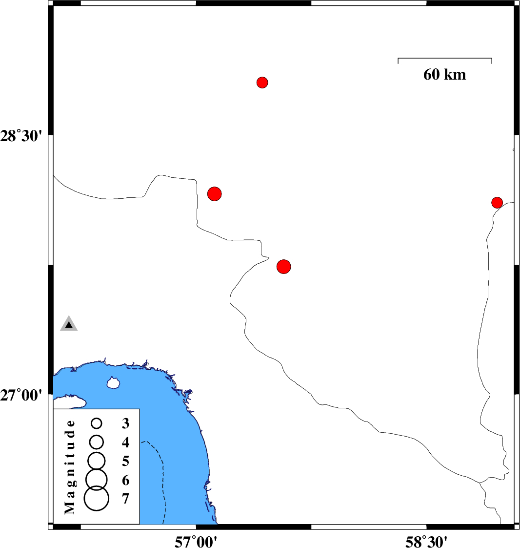
| 2013/09/25 | 16:18:37.2 | 19:48:37.2 | 27.74 | 57.57 | 14 | ML:4.1 | Kerman Province, 27 km South-West of Kahnuj | ||
| 2013/09/24 | 04:43:26.9 | 08:13:26.9 | 28.8 | 57.43 | 15 | ML:3.2 | Kerman Province, 34 km North-West of Jiroft | ||
| 2013/09/22 | 23:13:36.4 | 02:43:36.4 | 28.11 | 58.96 | 18 | ML:3.3 | Kerman Province, 125 km North-East of Kahnuj | ||
| 2013/09/21 | 06:27:33.9 | 10:57:33.9 | 28.16 | 57.12 | 14 | ML:4.1 | Kerman Province, 61 km North-West of Kahnuj |

 IIEES All Rights Reserved