Home / Recent Earthquakes

| Prel. Rep. | Date | Time(UTC) | Time(Local) | Lat. | Lon. | Depth | Mag. | Region | Waveform |
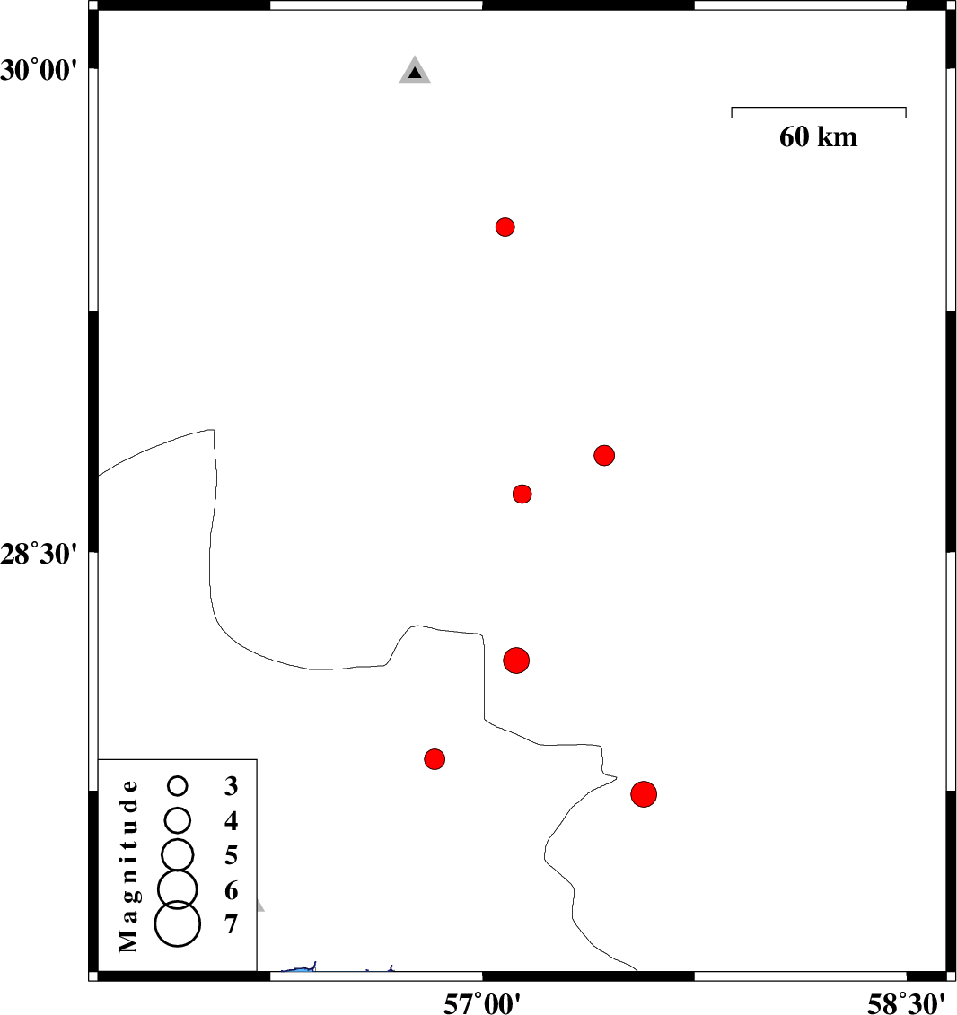
| 2013/10/03 | 22:12:34.4 | 01:42:34.4 | 28.68 | 57.14 | 39 | ML:2.9 | Kerman Province, 59 km West of Jiroft | ||
| 2013/10/01 | 17:16:42.8 | 20:46:42.8 | 29.51 | 57.08 | 14 | ML:3 | Kerman Province, 55 km North-East of Baft | ||
| 2013/09/25 | 16:18:37.2 | 19:48:37.2 | 27.74 | 57.57 | 14 | ML:4.1 | Kerman Province, 27 km South-West of Kahnuj | ||
| 2013/09/24 | 04:43:26.9 | 08:13:26.9 | 28.8 | 57.43 | 15 | ML:3.2 | Kerman Province, 34 km North-West of Jiroft | ||
| 2013/09/21 | 06:27:33.9 | 10:57:33.9 | 28.16 | 57.12 | 14 | ML:4.1 | Kerman Province, 61 km North-West of Kahnuj | ||
| 2013/09/05 | 02:59:06.9 | 07:29:06.9 | 27.85 | 56.83 | 14 | ML:3.3 | Hormozgan Province, 62 km North-West of Dehbarez |