Home / Recent Earthquakes

| Prel. Rep. | Date | Time(UTC) | Time(Local) | Lat. | Lon. | Depth | Mag. | Region | Waveform |
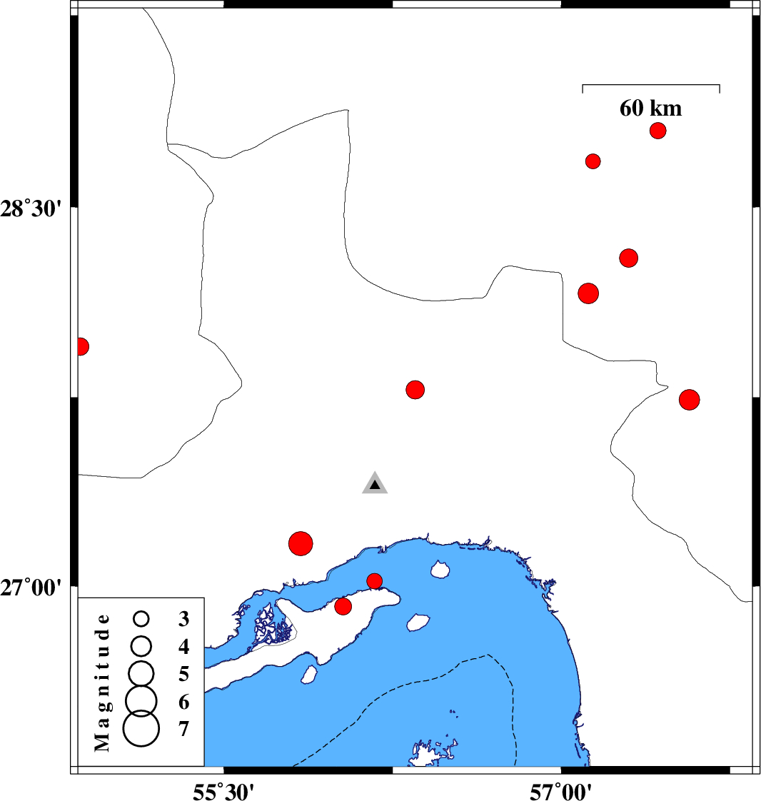
| 2013/10/16 | 14:43:08.8 | 18:13:08.8 | 27.78 | 56.35 | 16 | ML:3.6 | Hormozgan Province, 67 km North of Bandar-e abbas | ||
| 2013/10/15 | 12:52:18.8 | 16:22:18.8 | 28.3 | 57.3 | 14 | ML:3.6 | Kerman Province, 55 km North-West of Kahnuj | ||
| 2013/10/12 | 08:18:18.1 | 11:48:18.1 | 27.95 | 54.86 | 14 | ML:3.5 | Fars Province, 59 km North-East of Lar | ||
| 2013/10/08 | 02:52:07.3 | 06:22:07.3 | 27.17 | 55.84 | 15 | ML:4.8 | Hormozgan Province, 44 km West of Bandar-e abbas | ||
| 2013/10/03 | 22:12:34.4 | 01:42:34.4 | 28.68 | 57.14 | 39 | ML:2.9 | Kerman Province, 59 km West of Jiroft | ||
| 2013/09/25 | 16:18:37.2 | 19:48:37.2 | 27.74 | 57.57 | 14 | ML:4.1 | Kerman Province, 27 km South-West of Kahnuj | ||
| 2013/09/24 | 04:43:26.9 | 08:13:26.9 | 28.8 | 57.43 | 15 | ML:3.2 | Kerman Province, 34 km North-West of Jiroft | ||
| 2013/09/21 | 06:27:33.9 | 10:57:33.9 | 28.16 | 57.12 | 14 | ML:4.1 | Kerman Province, 61 km North-West of Kahnuj | ||
| 2013/09/17 | 17:28:18.4 | 21:58:18.4 | 27.02 | 56.17 | 15 | ML:3.1 | Persian Gulf, 12 km Qeshm | ||
| 2013/09/17 | 16:19:41.3 | 20:49:41.3 | 26.92 | 56.03 | 15 | ML:3.4 | Persian Gulf, 24 km West of Qeshm |