
| Prel. Rep. | Date | Time(UTC) | Time(Local) | Lat. | Lon. | Depth | Mag. | Region | Waveform |
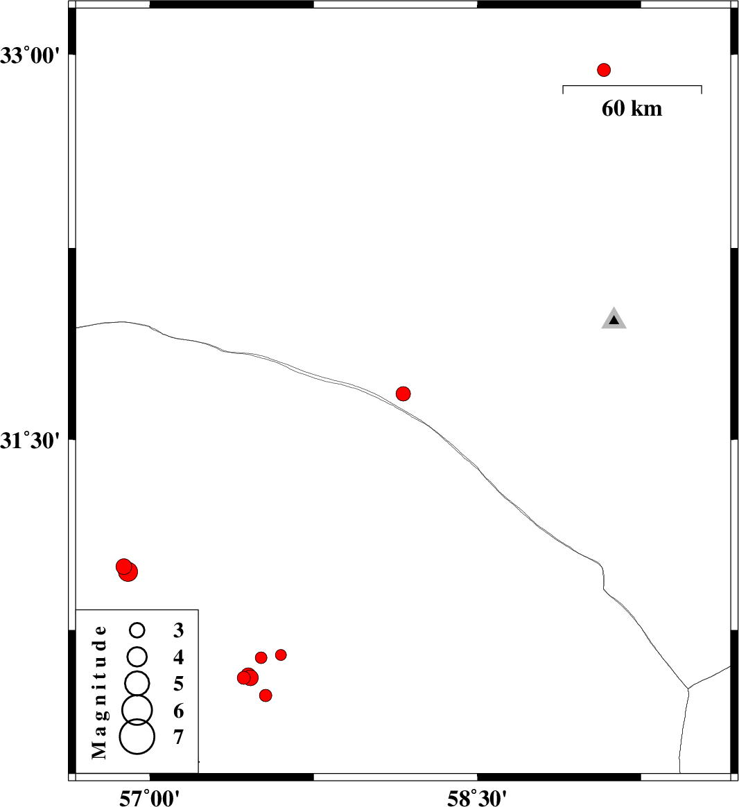
| 2014/04/29 | 21:50:04.8 | 02:20:04.8 | 31.68 | 58.16 | 14 | ML:2.9 | Khorasan(south) Province, 135 km North-East of Ravar | ||
| 2014/04/27 | 15:35:25.3 | 20:05:25.3 | 30.56 | 57.43 | 14 | ML:2.7 | Kerman Province, 45 km North-East of Kerman | ||
| 2014/04/24 | 05:16:31.7 | 09:46:31.7 | 30.56 | 57.46 | 14 | ML:3.2 | Kerman Province, 47 km North-East of Kerman | ||
| 2014/04/24 | 01:45:07.6 | 06:15:07.6 | 30.49 | 57.53 | 16 | ML:2.6 | Kerman Province, 49 km North-East of Kerman | ||
| 2014/04/24 | 01:29:09.6 | 05:59:09.6 | 30.57 | 57.45 | 15 | ML:3.1 | Kerman Province, 48 km North-East of Kerman | ||
| 2014/04/23 | 11:15:41.9 | 15:45:41.9 | 30.57 | 57.45 | 14 | ML:2.8 | Kerman Province, 47 km North-East of Kerman | ||
| 2014/04/14 | 02:28:47.7 | 06:58:47.7 | 32.94 | 59.08 | 14 | ML:2.7 | Khorasan(south) Province, 15 km West of Birjand | ||
| 2014/04/12 | 23:57:08.8 | 04:27:08.8 | 30.64 | 57.51 | 14 | ML:2.4 | Kerman Province, 56 km North-East of Kerman | ||
| 2014/04/12 | 01:51:38.6 | 06:21:38.6 | 31 | 56.88 | 14 | ML:3.2 | Kerman Province, 31 km South of Ravar | ||
| 2014/04/11 | 23:36:13.3 | 04:06:13.3 | 30.98 | 56.9 | 14 | ML:4 | Kerman Province, 33 km South of Ravar | ||
| 2014/04/01 | 15:00:21.8 | 19:30:21.8 | 30.65 | 57.6 | 18 | ML:2.2 | Kerman Province, 64 km North-East of Kerman |

 IIEES All Rights Reserved