Home / Recent Earthquakes

| Prel. Rep. | Date | Time(UTC) | Time(Local) | Lat. | Lon. | Depth | Mag. | Region | Waveform |
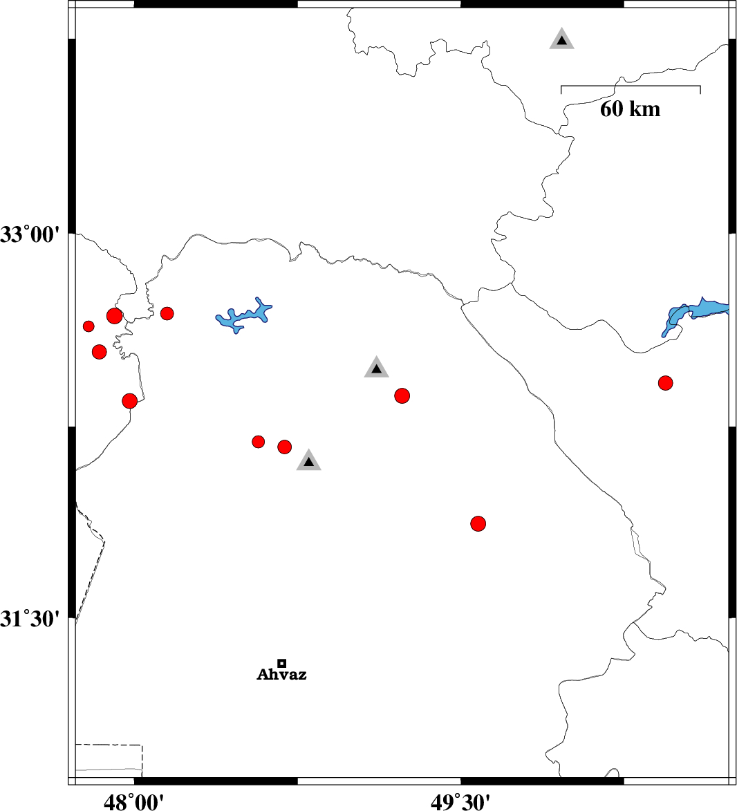
| 2014/11/03 | 00:35:51.2 | 04:05:51.2 | 32.37 | 49.23 | 16 | ML:3.1 | Khoozestan Province, 11 km East of Lali | ||
| 2014/10/31 | 01:49:37.7 | 05:19:37.7 | 32.17 | 48.69 | 18 | ML:2.8 | Khoozestan Province, 21 km North-West of Shushtar | ||
| 2014/10/29 | 17:06:45.5 | 20:36:45.5 | 32.54 | 47.84 | 14 | ML:2.9 | Ilam Province, 48 km West of Andimeshk | ||
| 2014/10/29 | 13:35:33.9 | 17:05:33.9 | 32.19 | 48.57 | 15 | ML:2.6 | Khoozestan Province, 30 km East of Shush | ||
| 2014/10/28 | 02:26:32.1 | 05:56:32.1 | 32.35 | 47.98 | 33 | ML:3.1 | Ilam Province, 31 km North-West of Shush | ||
| 2014/10/27 | 15:08:36.6 | 18:38:36.6 | 32.68 | 47.91 | 14 | ML:3.3 | Ilam Province, 60 km East of Dehloran | ||
| 2014/10/27 | 10:19:50.2 | 13:49:50.2 | 32.69 | 48.15 | 14 | ML:2.7 | Khoozestan Province, 32 km North-West of Andimeshk | ||
| 2014/10/27 | 08:12:02.1 | 11:42:02.1 | 31.87 | 49.58 | 16 | ML:3.1 | Khoozestan Province, 28 km West of Izeh | ||
| 2014/10/27 | 06:08:02.2 | 09:38:02.2 | 32.64 | 47.79 | 18 | ML:2.2 | Ilam Province, 50 km East of Dehloran | ||
| 2014/10/27 | 00:17:46.4 | 03:47:46.4 | 32.42 | 50.44 | 14 | ML:3 | Chaharmahal Bakhtiari Province, 22 km North-West of Farsan |