
Magnitude |
2.9 |
| Date & Time (UTC) | 2017-12-04 18:46:17.8 |
| Date & Time (Local) | 1396/9/13 22:16:17.8 |
| Location | Lat:28.12 Lon: 57.84 |
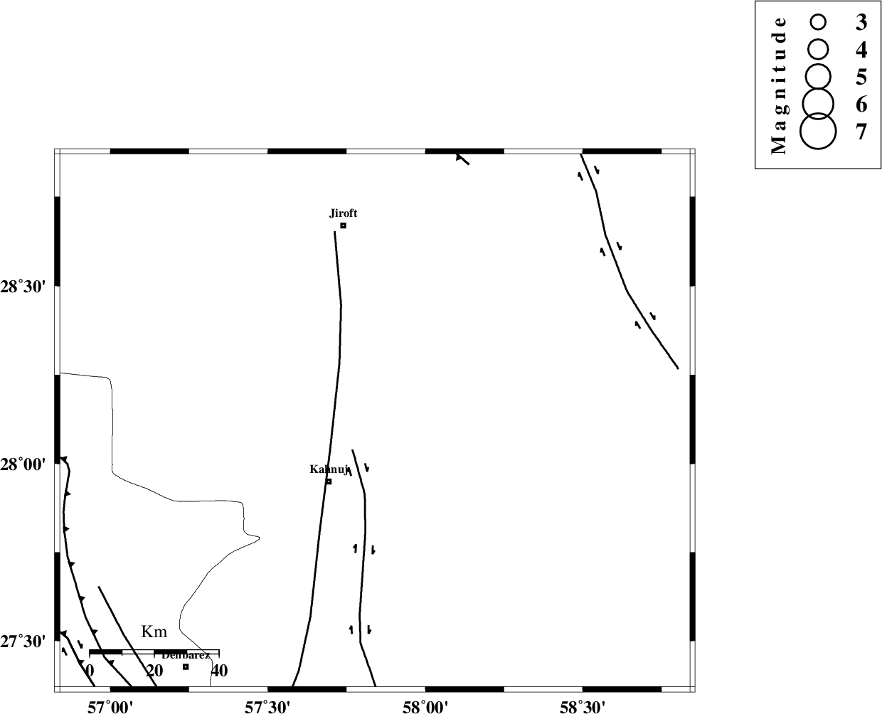
| Region | Kerman Province, 24 km North-East of Kahnuj |
Nearest Cities |
|
| 24 km North East of Kahnuj, Kerman Province | |
| 31 km East of Bolock, Kerman Province | |
| 35 km South West of Dosari, Kerman Province | |
| 35 km South of Aliabad-e qadiri, Kerman Province | |
| 42 km South West of Mardehak, Kerman Province | |
| Depth | 14 km |
| Agency | |
Faults within 150 km: |
|
| JIROFT_F (Length: 144 km) , Distance to epicenter: 11 km | |
| SABZEVARAN_F (Length: 190 km) , Distance to epicenter: 16 km | |
| GOWK_F (Length: 152 km) , Distance to epicenter: 85 km | |
| Number of Phases | 5 |
| RMS | 0 |
| Number of Stations | 3 |
| Error in Latitude | >1.6 km |
| Error in Longitude | 5.1 km |
| Error in Depth | 4.6 km |
Download waveform in seisan format
to download seisan software Click here
to access information about IIEES stations Click here
Amplitude | ||||||||
| UID | Agency | Station | Component | Amplitude | Period | Arrival Time | Proccessing Time | Signal Clip |
| 123604 | IIEES | GHIR | N | 14.8 | 0.15 | 2017-12-04 18:48:14 | 2017-12-05 08:10:00 | n |
| 123605 | IIEES | GHIR | E | 6.7 | 0.23 | 2017-12-04 18:48:15 | 2017-12-05 08:10:00 | n |
Phase | ||||||||||||
| Agency | Station | Component | Phase Type | Phase Quality | First Motion | Observed Arrival Time | Time Residual | Loc. Flag | Input Weight | Distance | Azimuth | |
| IIEES | BNDS | Z | Pg | E | 2017-12-04 18:46:47 | -0.05 | y | 183 | 244 | |||
| IIEES | BNDS | N | Sg | E | 2017-12-04 18:47:10 | 0.02 | y | 183 | 244 | |||
| IIEES | KRBR | Z | Pn | E | 2017-12-04 18:46:54 | 0.02 | y | 232 | 333 | |||
| IIEES | KRBR | N | Sg | E | 2017-12-04 18:47:23 | -0.02 | y | 232 | 333 | |||
| IIEES | GHIR | Z | Pn | E | 2017-12-04 18:47:24 | 0.04 | y | 477 | 273 | |||