Home / Recent Earthquakes

| Prel. Rep. | Date | Time(UTC) | Time(Local) | Lat. | Lon. | Depth | Mag. | Region | Waveform |
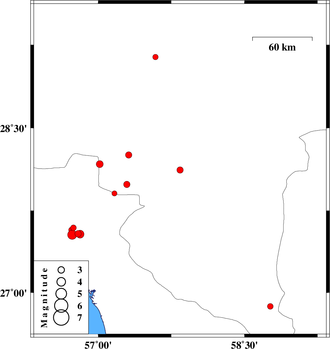
| 2017/12/04 | 18:46:17.8 | 22:16:17.8 | 28.12 | 57.84 | 14 | ML:2.9 | Kerman Province, 24 km North-East of Kahnuj | ||
| 2017/11/27 | 08:43:55.3 | 12:13:55.3 | 27.988 | 57.294 | 17 | ML:3 | Kerman Province, 40 km -West of Kahnuj | ||
| 2017/11/20 | 06:37:24.0 | 10:07:24.0 | 28.173 | 57.016 | 15 | ML:3.3 | Kerman Province, 71 km North-West of Kahnuj | ||
| 2017/11/14 | 23:07:00.6 | 02:37:00.6 | 28.256 | 57.313 | 14 | ML:2.9 | Kerman Province, 51 km North-West of Kahnuj | ||
| 2017/11/12 | 20:43:56.9 | 00:13:56.9 | 29.14 | 57.588 | 14 | ML:2.5 | Kerman Province, 54 km North-West of Jiroft | ||
| 2017/11/11 | 13:23:15.7 | 16:53:15.7 | 27.593 | 56.747 | 14 | ML:2.7 | Hormozgan Province, 52 km North-West of Dehbarez | ||
| 2017/11/11 | 08:00:28.2 | 11:30:28.2 | 27.54 | 56.794 | 14 | ML:2.9 | Hormozgan Province, 46 km North-West of Dehbarez | ||
| 2017/11/11 | 02:06:19.9 | 05:36:19.9 | 27.53 | 56.733 | 21 | ML:4.2 | Hormozgan Province, 51 km North-West of Dehbarez | ||
| 2017/11/11 | 00:37:00.9 | 04:07:00.9 | 27.535 | 56.814 | 14 | ML:3.7 | Hormozgan Province, 44 km North-West of Dehbarez | ||
| 2017/11/09 | 16:21:55.6 | 19:51:55.6 | 27.907 | 57.167 | 15 | ML:2.4 | Hormozgan Province, 54 km North of Dehbarez | ||
| 2017/11/09 | 11:37:16.8 | 15:07:16.8 | 27.574 | 56.728 | 14 | ML:2.7 | Hormozgan Province, 53 km North-West of Dehbarez | ||
| 2017/11/09 | 07:46:41.5 | 11:16:41.5 | 26.873 | 58.765 | 14 | ML:2.7 | Kerman Province, 139 km South-East of Manujan |