
Magnitude |
4.1 |
| Date & Time (UTC) | 2013-09-25 16:18:37.2 |
| Date & Time (Local) | 1392/7/3 19:48:37.2 |
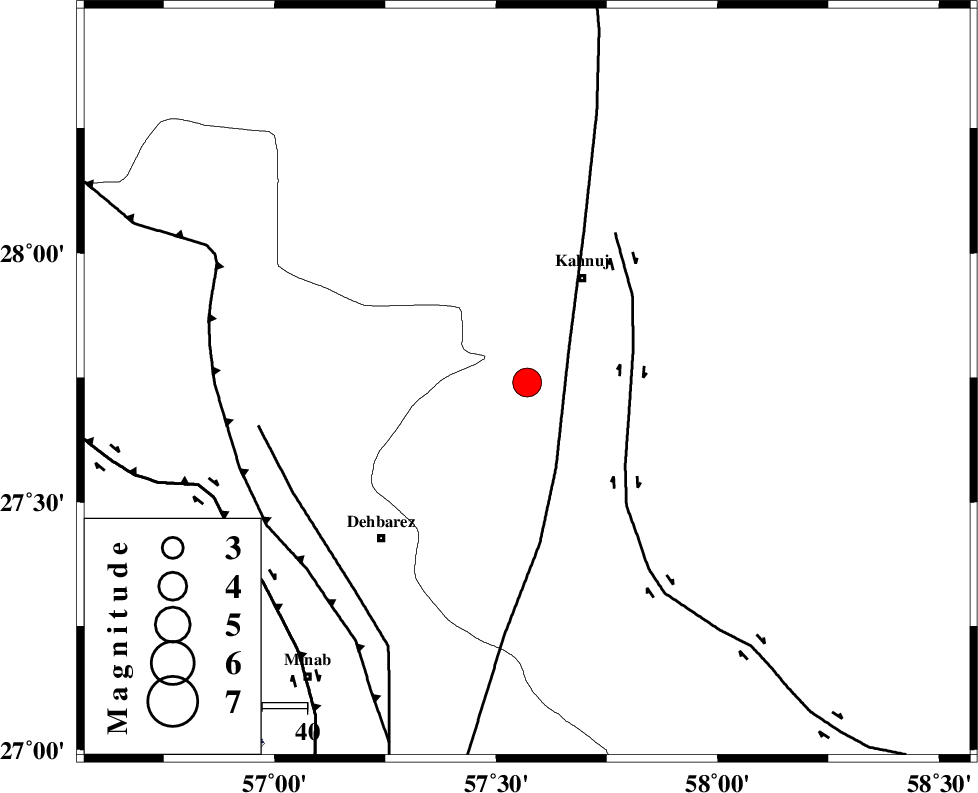
| Location | Lat:27.74 Lon: 57.57 |
| Region | Kerman Province, 27 km South-West of Kahnuj |
Nearest Cities |
|
| 15 km North of Bargah, Kerman Province | |
| 19 km North East of Bejogan, Kerman Province | |
| 25 km North East of Nodezh, Kerman Province | |
| 26 km South West of Kahnuj, Kerman Province | |
| 30 km East of Fariab, Hormozgan Province | |
| Depth | 14 km |
| Agency | |
Faults within 150 km: |
|
| SABZEVARAN_F (Length: 190 km) , Distance to epicenter: 12 km | |
| JIROFT_F (Length: 144 km) , Distance to epicenter: 23 km | |
| ZENDAN_MINAB_F_Z1 (Length: 183 km) , Distance to epicenter: 58 km | |
| Number of Phases | 7 |
| RMS | 0 |
| Number of Stations | 7 |
| Error in Latitude | >2.4 km |
| Error in Longitude | 3.8 km |
| Error in Depth | 6.1 km |
Download waveform in seisan format
to download seisan software Click here
to access information about IIEES stations Click here
Amplitude | ||||||||
| UID | Agency | Station | Component | Amplitude | Period | Arrival Time | Proccessing Time | Signal Clip |
| 90635 | IIEES | BNDS | N | 3924.2 | 0.44 | 2013-09-25 16:19:03 | 2013-09-25 06:03:00 | n |
| 90636 | IIEES | KRBR | N | 904.3 | 0.44 | 2013-09-25 16:19:44 | 2013-09-25 06:03:00 | n |
| 90637 | IIEES | KRBR | E | 914.2 | 0.4 | 2013-09-25 16:19:50 | 2013-09-25 06:03:00 | n |
Phase | ||||||||||||
| Agency | Station | Component | Phase Type | Phase Quality | First Motion | Observed Arrival Time | Time Residual | Loc. Flag | Input Weight | Distance | Azimuth | |
| IIEES | CHBR | Z | Pn | E | 2013-09-25 16:19:31 | 0 | y | 374 | 129 | |||
| IIEES | BSRN | Z | Pn | E | 2013-09-25 16:19:46 | 0.01 | y | 492 | 17 | |||
| IIEES | BSRN | N | Sg | E | 2013-09-25 16:20:54 | -0.01 | y | 492 | 17 | |||
| IIEES | YZKH | Z | Pn | E | 2013-09-25 16:19:58 | 0 | y | 591 | 332 | |||
| IIEES | TABS | Z | Pn | E | 2013-09-25 16:20:06 | -0.03 | y | 657 | 356 | |||
| IIEES | TABS | N | Sg | E | 2013-09-25 16:21:39 | 0.01 | y | 657 | 356 | |||
| IIEES | SHRT | Z | Pn | E | 2013-09-25 16:20:12 | 0.03 | y | 705 | 21 | |||