
| Prel. Rep. | Date | Time(UTC) | Time(Local) | Lat. | Lon. | Depth | Mag. | Region | Waveform |
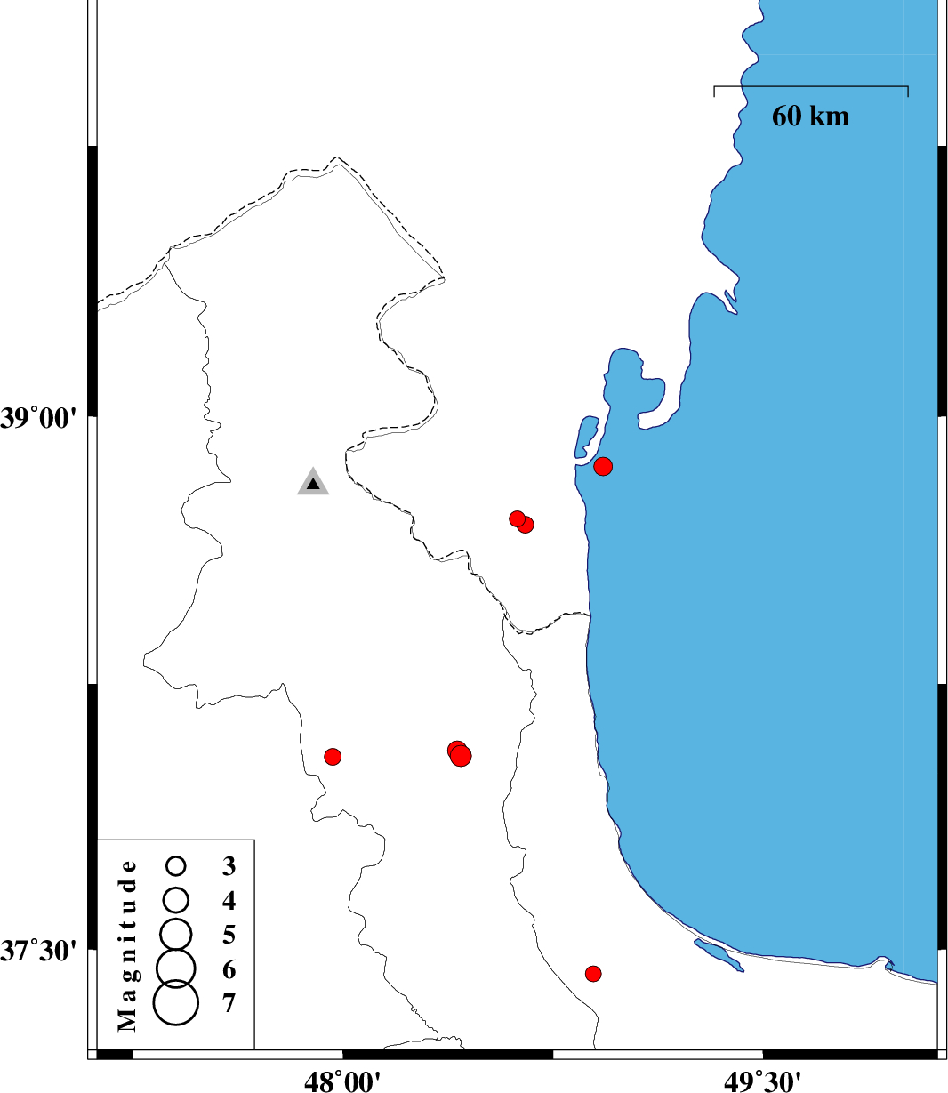
| 2015/10/30 | 17:00:11.9 | 20:30:11.9 | 38.713 | 48.622 | 11 | ML:2.6 | Azerbaijan, 34 km North-East of Namin | ||
| 2015/10/30 | 16:59:20.0 | 20:29:20.0 | 38.697 | 48.65 | 20 | ML:2.7 | Azerbaijan, 33 km North-East of Namin | ||
| 2015/10/16 | 23:38:52.7 | 03:08:52.7 | 38.045 | 47.964 | 17 | ML:2.7 | Ardebil Province, 15 km -West of Nir | ||
| 2015/10/15 | 04:04:09.6 | 07:34:09.6 | 38.86 | 48.928 | 15 | ML:3 | Caspian Sea, 49 km North of Astara | ||
| 2015/10/11 | 19:11:30.6 | 22:41:30.6 | 38.047 | 48.42 | 14 | ML:3.4 | Ardebil Province, 26 km -East of Nir | ||
| 2015/10/11 | 12:30:53.4 | 16:00:53.4 | 38.063 | 48.408 | 14 | ML:3.1 | Ardebil Province, 25 km -East of Nir | ||
| 2015/10/04 | 13:08:32.3 | 16:38:32.3 | 37.455 | 47.623 | 14 | ML:2.6 | Azarbaijan Sharghi Province, 9 km of Mianeh | ||
| 2015/10/02 | 04:07:35.1 | 07:37:35.1 | 37.43 | 48.893 | 14 | ML:2.6 | Gilan Province, 24 km -West of Masal |

 IIEES All Rights Reserved