Home / Recent Earthquakes

| Prel. Rep. | Date | Time(UTC) | Time(Local) | Lat. | Lon. | Depth | Mag. | Region | Waveform |
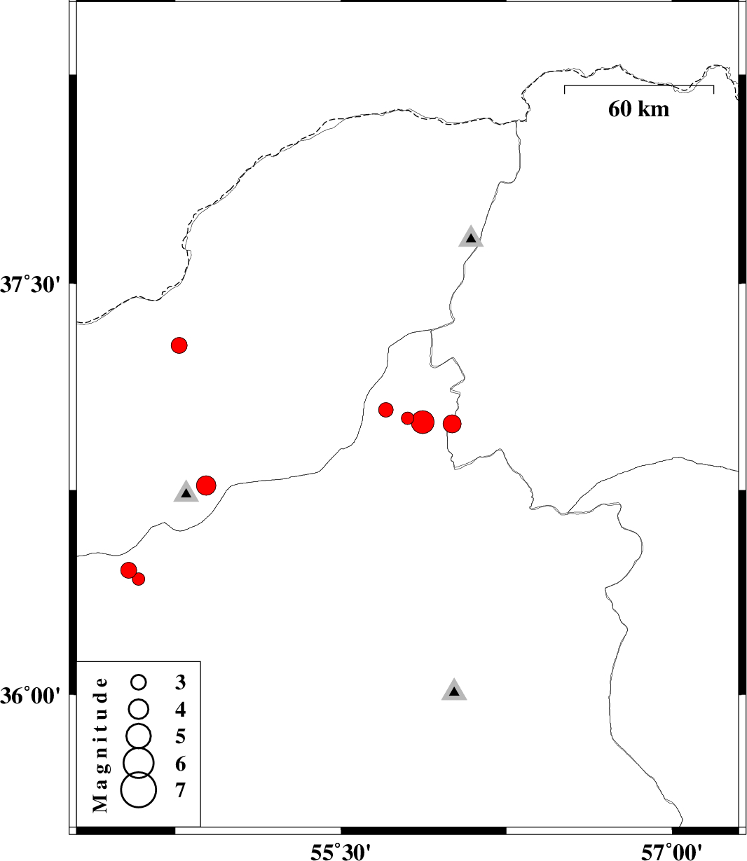
| 2016/12/28 | 01:03:15.0 | 04:33:15.0 | 37.011 | 55.802 | 0 | ML:2.5 | Semnan Province, 44 km South-East of Minodasht | ||
| 2016/12/28 | 00:01:39.6 | 03:31:39.6 | 37.042 | 55.703 | 14 | ML:2.9 | Semnan Province, 35 km South-East of Minodasht | ||
| 2016/12/27 | 20:56:19.6 | 00:26:19.6 | 36.997 | 55.871 | 6 | ML:4.6 | Semnan Province, 46 km -West of Jajarm | ||
| 2016/12/25 | 09:38:52.7 | 13:08:52.7 | 37.276 | 54.767 | 18 | ML:3.2 | Golestan Province, 34 km -West of Gonbad-e kavus | ||
| 2016/12/23 | 22:59:07.2 | 02:29:07.2 | 36.457 | 54.539 | 14 | ML:3.2 | Semnan Province, 39 km -West of Shahrud | ||
| 2016/12/23 | 22:31:27.3 | 02:01:27.3 | 36.425 | 54.583 | 15 | ML:2.5 | Semnan Province, 34 km -West of Shahrud | ||
| 2016/12/15 | 22:01:30.6 | 01:31:30.6 | 36.991 | 56.004 | 9 | ML:3.7 | Khorasan(north) Province, 34 km -West of Jajarm | ||
| 2016/12/02 | 22:29:51.0 | 01:59:51.0 | 36.767 | 54.889 | 15 | ML:4 | Golestan Province, 15 km South of Ali Abad |