Home / Recent Earthquakes

| Prel. Rep. | Date | Time(UTC) | Time(Local) | Lat. | Lon. | Depth | Mag. | Region | Waveform |
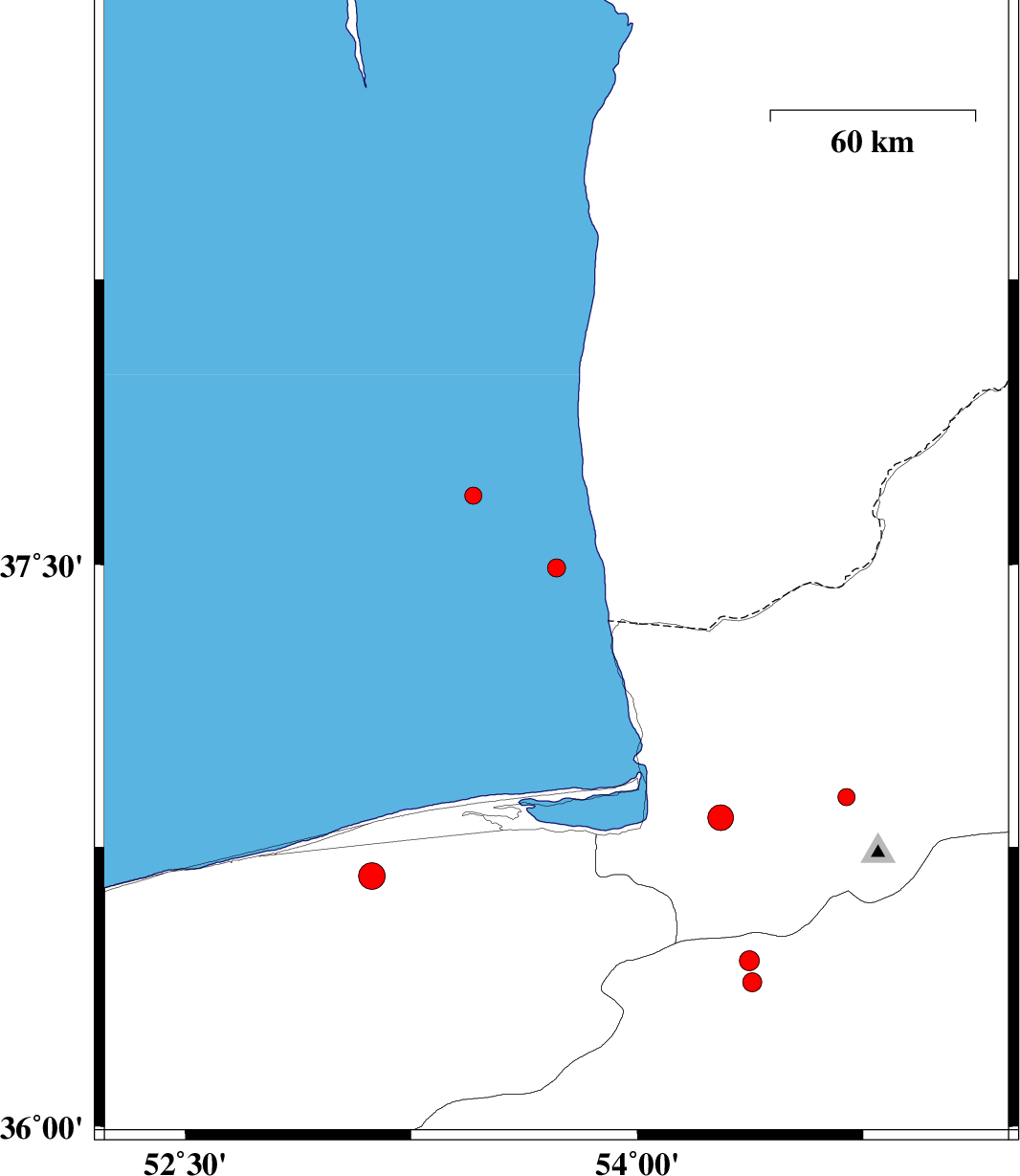
| 2017/04/16 | 16:23:29.4 | 20:53:29.4 | 37.491 | 53.732 | 15 | ML:2.7 | Caspian Sea, 72 km North-West of Bandar-e torkaman | ||
| 2017/04/14 | 21:14:32.9 | 01:44:32.9 | 37.682 | 53.456 | 15 | ML:2.5 | Caspian Sea | ||
| 2017/04/09 | 05:40:01.7 | 10:10:01.7 | 36.445 | 54.372 | 15 | ML:2.9 | Semnan Province, 31 km North of Damghan | ||
| 2017/04/07 | 20:19:04.2 | 00:49:04.2 | 36.387 | 54.381 | 28 | ML:2.8 | Semnan Province, 25 km North of Damghan | ||
| 2017/03/22 | 19:53:25.2 | 00:23:25.2 | 36.827 | 54.277 | 15 | ML:3.8 | Golestan Province, 14 km -West of Gorgan | ||
| 2017/03/20 | 09:17:14.1 | 12:47:14.1 | 36.672 | 53.12 | 15 | ML:4 | Mazandaran Province, 13 km North of Sari | ||
| 2017/03/20 | 00:30:47.0 | 04:00:47.0 | 36.882 | 54.695 | 15 | ML:2.5 | Golestan Province, 16 km -West of Ali Abad |