Home / Recent Earthquakes

| Prel. Rep. | Date | Time(UTC) | Time(Local) | Lat. | Lon. | Depth | Mag. | Region | Waveform |
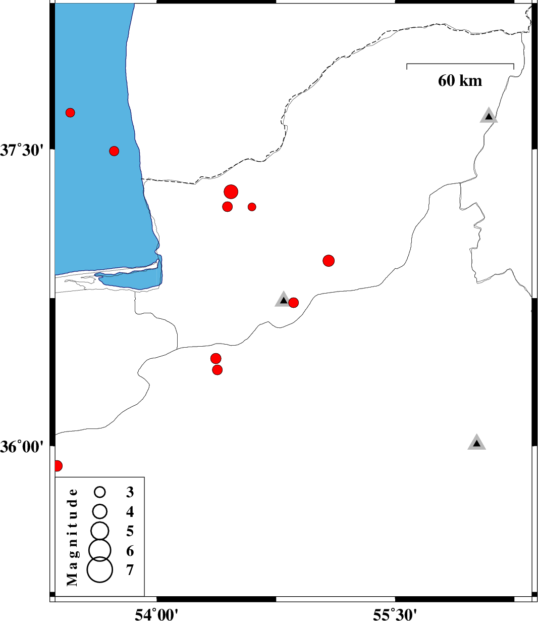
| 2017/05/03 | 06:28:40.2 | 10:58:40.2 | 36.727 | 54.86 | 6 | ML:2.8 | Golestan Province, 20 km South of Ali Abad | ||
| 2017/04/29 | 13:37:23.7 | 18:07:23.7 | 37.211 | 54.444 | 14 | ML:2.8 | Golestan Province, 22 km North of Aq Qaleh | ||
| 2017/04/27 | 11:20:16.2 | 15:50:16.2 | 35.898 | 53.371 | 15 | ML:3.1 | Semnan Province, 37 km North of Semnan | ||
| 2017/04/25 | 11:54:44.1 | 16:24:44.1 | 37.21 | 54.598 | 15 | ML:2.3 | Golestan Province, 25 km North-East of Aq Qaleh | ||
| 2017/04/22 | 13:37:40.8 | 18:07:40.8 | 37.287 | 54.466 | 16 | ML:4 | Golestan Province, 31 km North of Aq Qaleh | ||
| 2017/04/18 | 03:47:25.0 | 08:17:25.0 | 36.94 | 55.081 | 14 | ML:3.2 | Golestan Province, 10 km of Ramian | ||
| 2017/04/16 | 16:23:29.4 | 20:53:29.4 | 37.491 | 53.732 | 15 | ML:2.7 | Caspian Sea, 72 km North-West of Bandar-e torkaman | ||
| 2017/04/14 | 21:14:32.9 | 01:44:32.9 | 37.682 | 53.456 | 15 | ML:2.5 | Caspian Sea | ||
| 2017/04/09 | 05:40:01.7 | 10:10:01.7 | 36.445 | 54.372 | 15 | ML:2.9 | Semnan Province, 31 km North of Damghan | ||
| 2017/04/07 | 20:19:04.2 | 00:49:04.2 | 36.387 | 54.381 | 28 | ML:2.8 | Semnan Province, 25 km North of Damghan |