Home / Recent Earthquakes

| Prel. Rep. | Date | Time(UTC) | Time(Local) | Lat. | Lon. | Depth | Mag. | Region | Waveform |
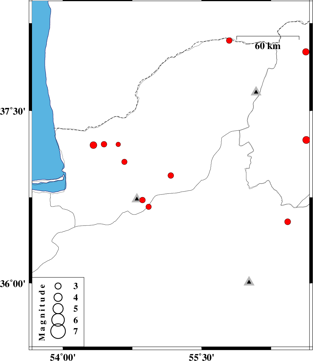
| 2017/05/24 | 04:14:35.0 | 08:44:35.0 | 36.94 | 55.166 | 14 | ML:2.8 | Golestan Province, 8 km of Ramian | ||
| 2017/05/20 | 11:35:18.0 | 16:05:18.0 | 37.059 | 54.665 | 17 | ML:2.7 | Golestan Province, 19 km -East of Aq Qaleh | ||
| 2017/05/20 | 06:13:36.0 | 10:43:36.0 | 36.668 | 54.926 | 14 | ML:2.7 | Semnan Province, 28 km North of Shahrud | ||
| 2017/05/19 | 06:22:54.3 | 10:52:54.3 | 38.006 | 56.626 | 14 | ML:3.2 | Khorasan(north) Province, 58 km North-West of Ashkhaneh | ||
| 2017/05/17 | 13:12:13.5 | 17:42:13.5 | 36.538 | 56.43 | 6 | ML:2.9 | Semnan Province, 46 km South of Jajarm | ||
| 2017/05/16 | 07:34:17.1 | 12:04:17.1 | 37.204 | 54.33 | 15 | ML:3.4 | Golestan Province, 24 km North-West of Aq Qaleh | ||
| 2017/05/05 | 08:12:01.8 | 12:42:01.8 | 38.102 | 55.798 | 14 | ML:2.8 | Golestan Province, 85 km North-East of Kalaleh | ||
| 2017/05/03 | 06:28:40.2 | 10:58:40.2 | 36.727 | 54.86 | 6 | ML:2.8 | Golestan Province, 20 km South of Ali Abad | ||
| 2017/04/29 | 13:37:23.7 | 18:07:23.7 | 37.211 | 54.444 | 14 | ML:2.8 | Golestan Province, 22 km North of Aq Qaleh | ||
| 2017/04/25 | 11:54:44.1 | 16:24:44.1 | 37.21 | 54.598 | 15 | ML:2.3 | Golestan Province, 25 km North-East of Aq Qaleh | ||
| 2017/04/24 | 15:18:16.8 | 19:48:16.8 | 37.248 | 56.631 | 15 | ML:3.5 | Khorasan(north) Province, 39 km North-East of Jajarm |