Home / Recent Earthquakes

| Prel. Rep. | Date | Time(UTC) | Time(Local) | Lat. | Lon. | Depth | Mag. | Region | Waveform |
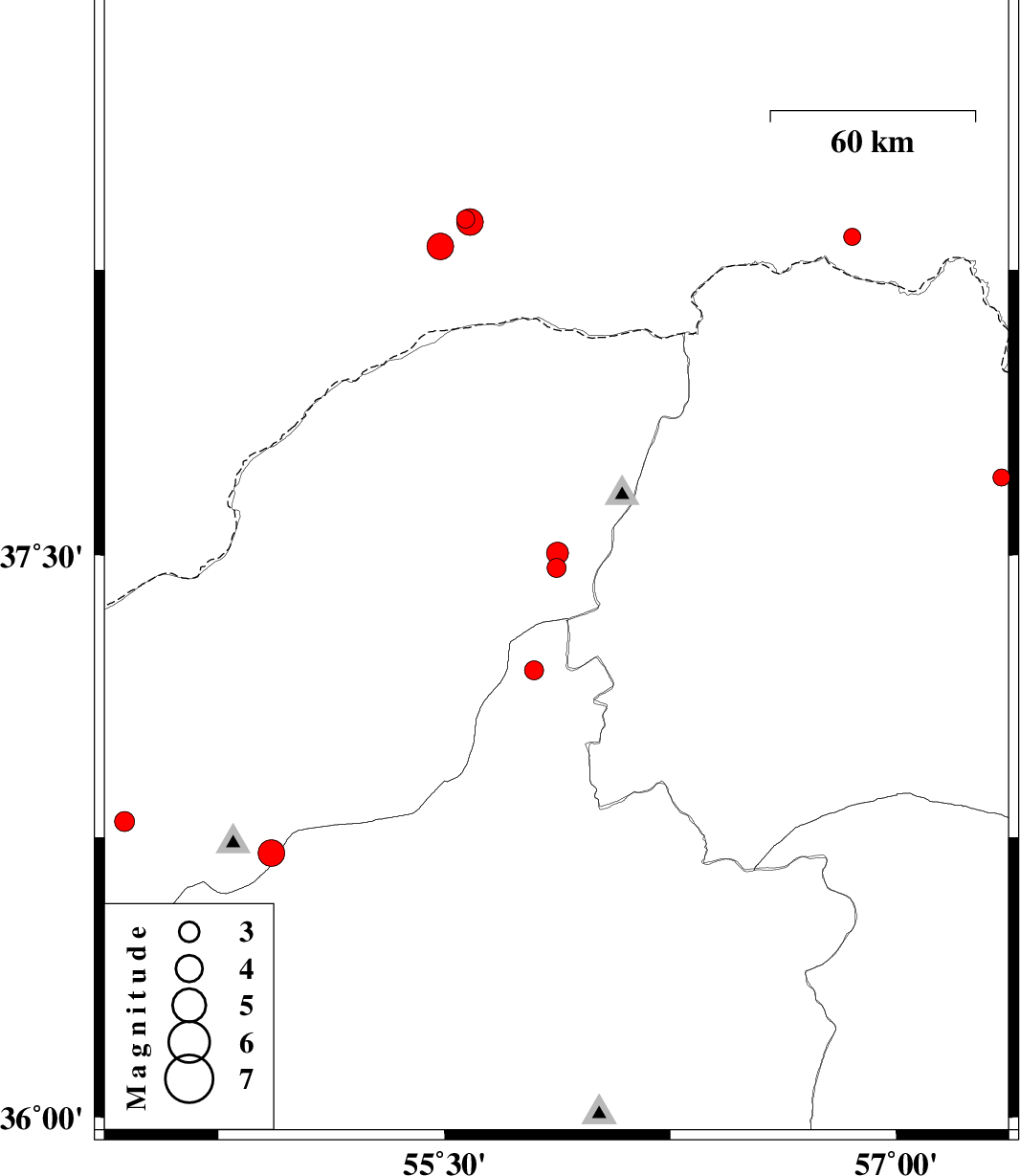
| 2017/03/16 | 10:09:54.8 | 13:39:54.8 | 38.337 | 56.853 | 6 | ML:2.5 | Turkmenistan, 88 km North of Ashkhaneh | ||
| 2017/03/16 | 00:53:57.4 | 04:23:57.4 | 37.466 | 55.872 | 9 | ML:2.8 | Golestan Province, 35 km -East of Kalaleh | ||
| 2017/03/16 | 00:48:25.7 | 04:18:25.7 | 37.505 | 55.876 | 16 | ML:3.2 | Golestan Province, 37 km North-East of Kalaleh | ||
| 2017/03/15 | 07:07:33.6 | 10:37:33.6 | 38.383 | 55.571 | 14 | ML:2.7 | Turkmenistan | ||
| 2017/03/14 | 04:44:38.4 | 08:14:38.4 | 38.312 | 55.487 | 14 | ML:3.9 | Turkmenistan | ||
| 2017/03/14 | 04:05:22.4 | 07:35:22.4 | 38.376 | 55.585 | 14 | ML:4 | Turkmenistan | ||
| 2017/03/12 | 19:08:10.5 | 22:38:10.5 | 36.708 | 54.926 | 17 | ML:4 | Golestan Province, 23 km South of Ali Abad | ||
| 2017/03/10 | 01:33:39.6 | 05:03:39.6 | 37.195 | 55.797 | 8 | ML:2.8 | Semnan Province, 36 km -East of Minodasht | ||
| 2017/03/09 | 04:36:51.8 | 08:06:51.8 | 37.705 | 57.348 | 6 | ML:2.5 | Khorasan(north) Province, 26 km North of Bojnurd | ||
| 2017/03/01 | 10:19:44.1 | 13:49:44.1 | 36.793 | 54.439 | 15 | ML:3 | Golestan Province, 5 km of Gorgan |