Home / Recent Earthquakes

| Prel. Rep. | Date | Time(UTC) | Time(Local) | Lat. | Lon. | Depth | Mag. | Region | Waveform |
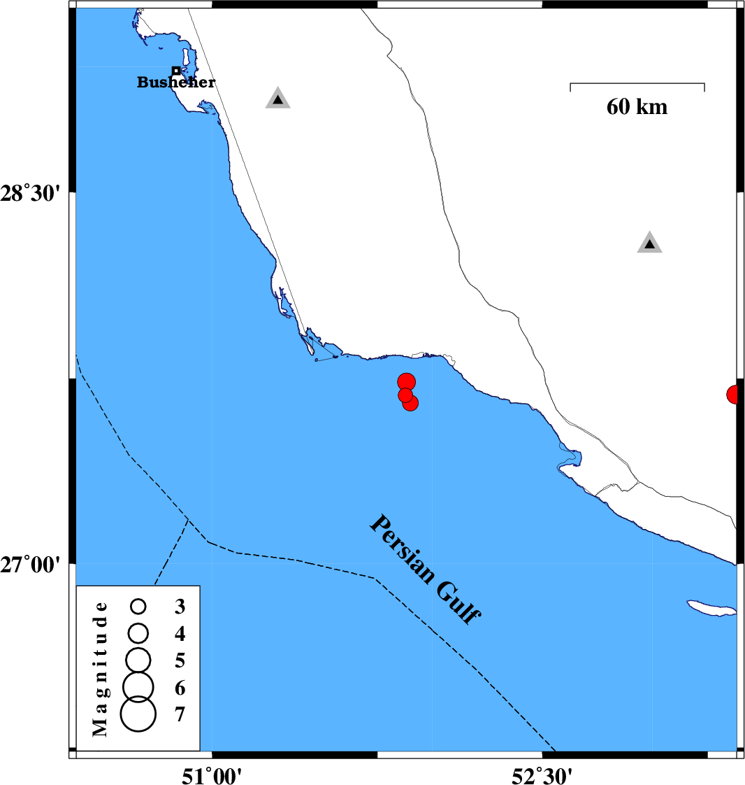
| 2017/12/27 | 01:09:25.9 | 04:39:25.9 | 27.681 | 51.878 | 18 | ML:3 | Persian Gulf, 24 km South-West of Bandar-e kangan | ||
| 2017/12/27 | 00:34:04.9 | 04:04:04.9 | 27.735 | 51.882 | 17 | ML:3.6 | Persian Gulf, 20 km -West of Bandar-e kangan | ||
| 2017/12/24 | 10:57:15.1 | 14:27:15.1 | 27.685 | 53.379 | 14 | ML:3.8 | Fars Province, 44 km North-East of Lamerd | ||
| 2017/12/22 | 21:43:33.7 | 01:13:33.7 | 27.65 | 51.899 | 14 | ML:3.3 | Persian Gulf, 25 km South-West of Bandar-e kangan |