Home / Recent Earthquakes

| Prel. Rep. | Date | Time(UTC) | Time(Local) | Lat. | Lon. | Depth | Mag. | Region | Waveform |
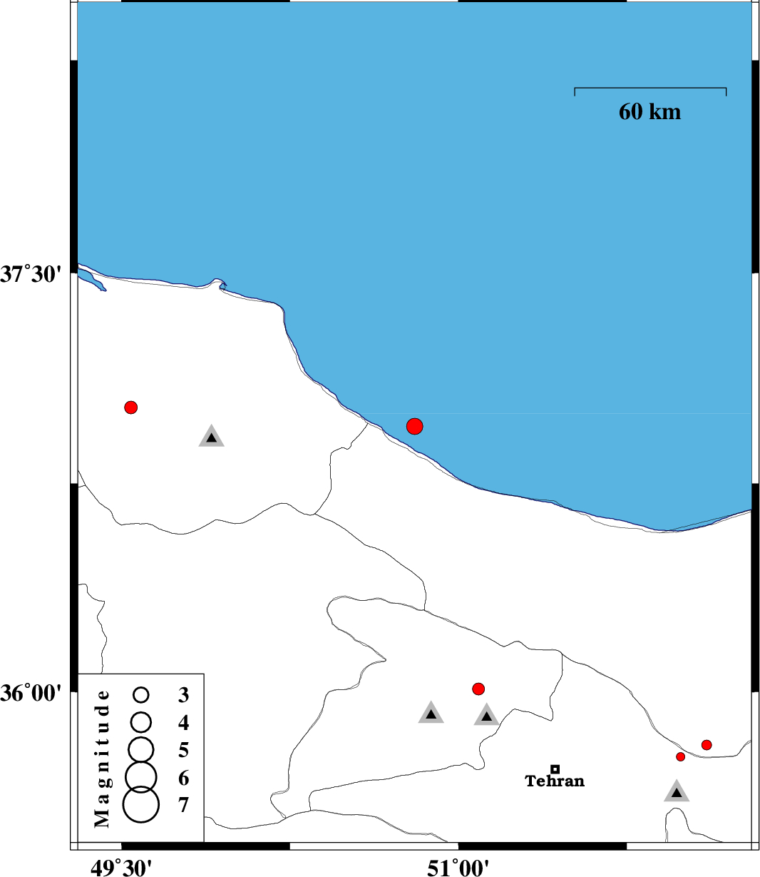
| 2018/02/18 | 22:04:02.0 | 01:34:02.0 | 36.954 | 50.805 | 15 | ML:3.3 | Caspian Sea, 15 km -East of Ramsar | ||
| 2018/02/10 | 21:18:39.2 | 00:48:39.2 | 35.765 | 51.99 | 12 | ML:1.7 | Tehran Province, 9 km of Damavand | ||
| 2018/02/06 | 21:25:26.9 | 00:55:26.9 | 35.621 | 49.722 | 14 | ML:2.5 | Ghazvin Province, 49 km South of Takestan | ||
| 2018/02/05 | 00:33:20.4 | 04:03:20.4 | 37.022 | 49.542 | 15 | ML:2.5 | Gilan Province, 20 km South-East of Shaft | ||
| 2018/01/30 | 13:37:14.6 | 17:07:14.6 | 35.808 | 52.105 | 7 | ML:2 | Mazandaran Province, 11 km of Damavand | ||
| 2018/01/22 | 05:33:20.4 | 09:03:20.4 | 36.01 | 51.09 | 14 | ML:2.4 | Tehran Province, 26 km North-East of Karaj |