Home / Recent Earthquakes

| Prel. Rep. | Date | Time(UTC) | Time(Local) | Lat. | Lon. | Depth | Mag. | Region | Waveform |
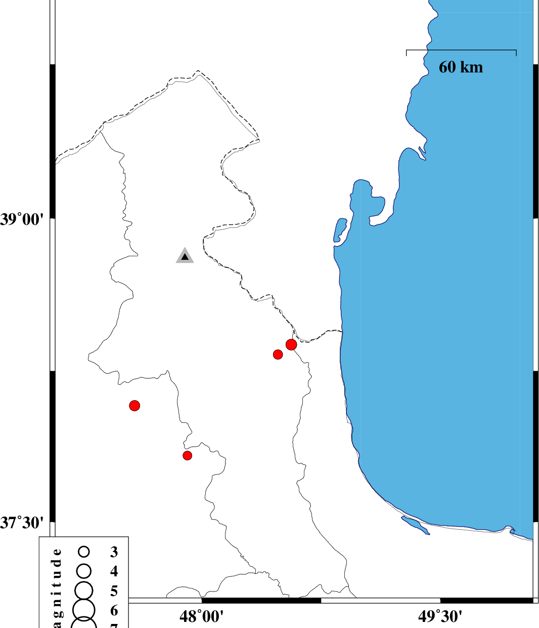
| 2018/12/16 | 11:25:48.6 | 14:55:48.6 | 38.619 | 48.58 | 16 | ML:2.7 | Azerbaijan, 23 km North-East of Namin | ||
| 2018/12/10 | 12:52:41.3 | 16:22:41.3 | 38.12 | 48.012 | 16 | ML:2.6 | Ardebil Province, 12 km -West of Nir | ||
| 2018/11/30 | 17:02:59.6 | 20:32:59.6 | 38.667 | 48.665 | 7 | ML:3.1 | Azerbaijan, 32 km North-West of Astara | ||
| 2018/11/26 | 20:09:19.6 | 23:39:19.6 | 37.788 | 47.137 | 15 | ML:3.4 | Azarbaijan Sharghi Province, 26 km -East of Bostanabad | ||
| 2018/11/23 | 15:03:22.0 | 18:33:22.0 | 38.367 | 47.681 | 14 | ML:2.9 | Ardebil Province, 4 km of Meshgin Shahr |