| Prel. Rep. | Date | Time(UTC) | Time(Local) | Lat. | Lon. | Depth | Mag. | Region | Waveform |
|
|
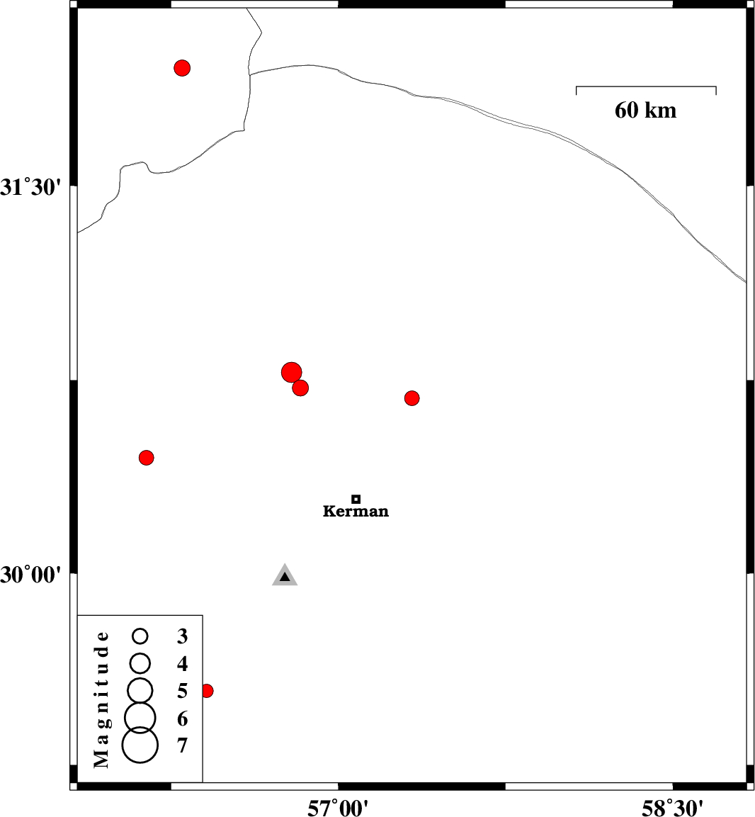
2009/04/04
|
22:34:26.3
|
03:04:26.3
| 30.68 | 57.33 | 18 |
ML:2.9
|
49 km North-East of Kerman, Kerman Province | |
|
|
2009/03/27
|
19:33:17.0
|
00:03:17.0
| 29.54 | 56.41 | 15 |
ML:2.7
|
38 km North-West of Baft, Kerman Province | |
|
|
2009/03/24
|
20:32:53.2
|
01:02:53.2
| 31.95 | 56.3 | 8 |
ML:3.2
|
90 km North-West of Ravar, Kerman Province | |
|
|
2009/03/11
|
04:27:57.3
|
07:57:57.3
| 30.45 | 56.14 | 14 |
ML:2.9
|
14 km East of Rafsanjan, Kerman Province | |
|
|
2009/03/08
|
10:49:00.4
|
14:19:00.4
| 30.72 | 56.83 | 14 |
ML:3.2
|
27 km East of Zarand, Kerman Province | |
|
|
2009/03/07
|
06:47:07.6
|
10:17:07.6
| 30.78 | 56.79 | 8 |
ML:4.1
|
21 km East of Zarand, Kerman Province | |