| Prel. Rep. | Date | Time(UTC) | Time(Local) | Lat. | Lon. | Depth | Mag. | Region | Waveform |
|
|
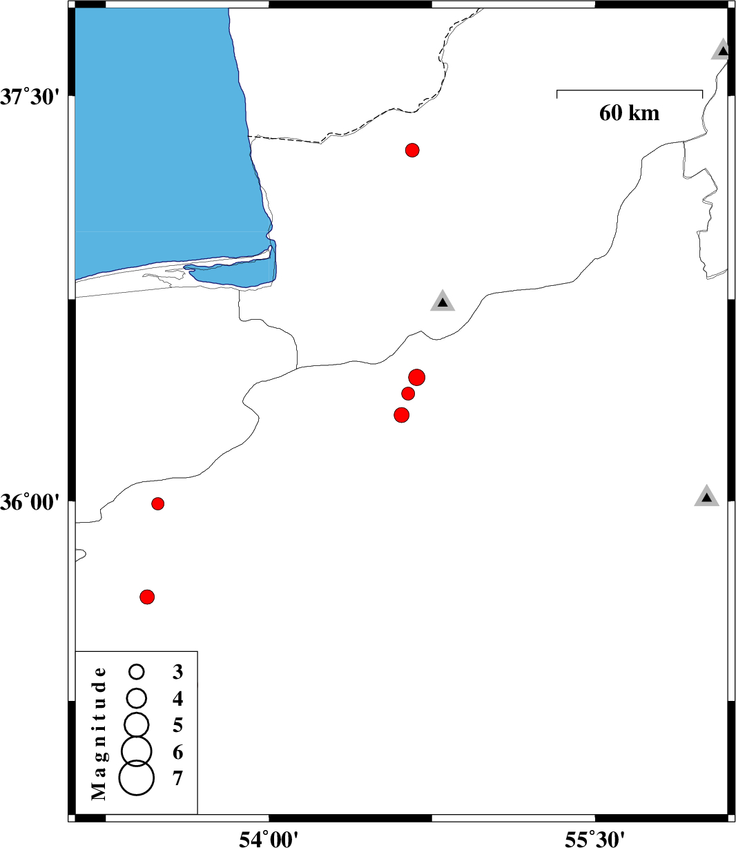
2010/01/13
|
13:18:48.7
|
16:48:48.7
| 36.32 | 54.61 | 14 |
ML:3.1
|
28 km North-East of Damghan, Semnan Province | |
|
|
2010/01/04
|
07:23:10.8
|
10:53:10.8
| 35.64 | 53.44 | 14 |
ML:3
|
8 km Semnan, Semnan Province | |
|
|
2010/01/03
|
16:39:52.9
|
20:09:52.9
| 37.3 | 54.66 | 14 |
ML:2.8
|
36 km North-East of Aq Qaleh, Golestan Province | |
|
|
2009/12/30
|
15:38:46.8
|
19:08:46.8
| 36.4 | 54.64 | 14 |
ML:2.7
|
Semnan Province, 30 km West of Shahrud | |
|
|
2009/12/25
|
22:15:43.8
|
01:45:43.8
| 35.99 | 53.49 | 16 |
ML:2.5
|
Semnan Province, 48 km North of Semnan | |
|
|
2009/12/19
|
04:10:23.8
|
07:40:23.8
| 36.46 | 54.68 | 18 |
ML:3.4
|
Semnan Province, 26 km West of Shahrud | |
|
|
2009/12/18
|
13:14:40.1
|
16:44:40.1
| 35.31 | 53.64 | 14 |
ML:2.9
|
Semnan Province, 36 km South-East of Semnan | |