| Prel. Rep. | Date | Time(UTC) | Time(Local) | Lat. | Lon. | Depth | Mag. | Region | Waveform |
|
|
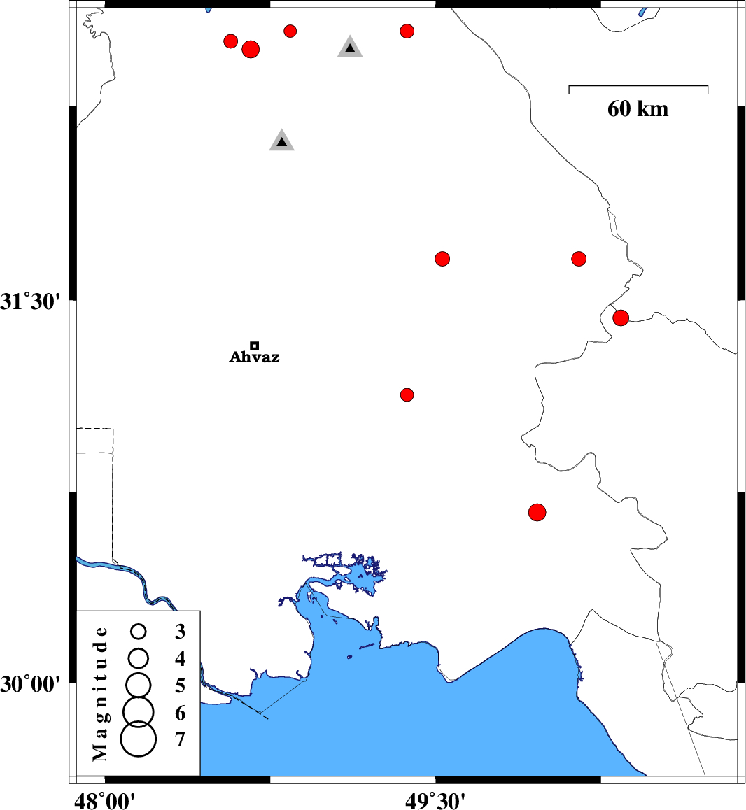
2010/12/29
|
03:43:33.6
|
07:13:33.6
| 31.13 | 49.37 | 25 |
ML:2.7
|
Khoozestan Province, 28 km South-West of Ramhormoz | |
|
|
2010/12/26
|
00:24:18.1
|
03:54:18.1
| 32.54 | 48.84 | 14 |
ML:2.5
|
Khoozestan Province, 30 km North-West of Lali | |
|
|
2010/12/15
|
19:51:33.7
|
23:21:33.7
| 31.43 | 50.34 | 16 |
ML:3.2
|
Kohkiluieh va boyerahmad Province, 45 km West of Lordegan | |
|
|
2010/12/15
|
09:15:09.9
|
12:45:09.9
| 30.67 | 49.96 | 18 |
ML:3.5
|
Khoozestan Province, 26 km East of Omidiyeh | |
|
|
2010/12/12
|
23:56:36.6
|
03:26:36.6
| 32.5 | 48.57 | 18 |
ML:2.8
|
Khoozestan Province, 21 km East of Andimeshk | |
|
|
2010/12/08
|
21:07:05.0
|
00:37:05.0
| 32.54 | 49.37 | 15 |
ML:2.8
|
Khoozestan Province, 29 km North-East of Lali | |
|
|
2010/12/08
|
19:24:50.0
|
22:54:50.0
| 32.47 | 48.66 | 25 |
ML:3.5
|
Khoozestan Province, 29 km East of Andimeshk | |
|
|
2010/12/02
|
07:10:53.4
|
10:40:53.4
| 31.66 | 49.53 | 40 |
ML:2.9
|
Khoozestan Province, 43 km North of Ramhormoz | |
|
|
2010/11/29
|
06:07:57.1
|
09:37:57.1
| 31.66 | 50.15 | 18 |
ML:3
|
Khoozestan Province, 29 km North-East of Bagh Malek | |