| Prel. Rep. | Date | Time(UTC) | Time(Local) | Lat. | Lon. | Depth | Mag. | Region | Waveform |
|
|
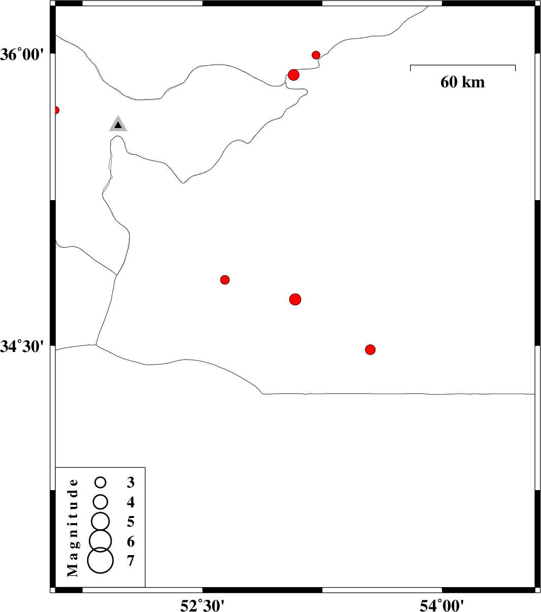
2012/11/22
|
17:47:37.1
|
21:17:37.1
| 34.74 | 53.08 | 14 |
ML:3.2
|
Semnan Province, 97 km South-West of Semnan | |
|
|
2012/11/18
|
16:08:20.9
|
19:38:20.9
| 34.48 | 53.55 | 18 |
ML:2.8
|
Semnan Province, 121 km South-East of Semnan | |
|
|
2012/11/11
|
16:00:44.8
|
19:30:44.8
| 34.84 | 52.64 | 17 |
ML:2.6
|
Semnan Province, 50 km South-East of Garmsar | |
|
|
2012/11/01
|
19:31:01.7
|
23:01:01.7
| 35.89 | 53.07 | 15 |
ML:3.1
|
Semnan Province, 25 km South of Pol-E-Sefid | |
|
|
2012/10/23
|
20:49:06.5
|
00:19:06.5
| 35.99 | 53.21 | 37 |
ML:2.2
|
Mazandaran Province, 19 km South-East of Pol-E-Sefid | |
|
|
2012/10/23
|
09:25:22.7
|
12:55:22.7
| 35.71 | 51.58 | 26 |
ML:2.1
|
Tehran Province, 17 km East of Tehran | |