Home / Recent Earthquakes

| Prel. Rep. | Date | Time(UTC) | Time(Local) | Lat. | Lon. | Depth | Mag. | Region | Waveform |
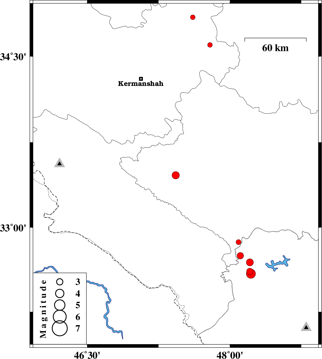
| 2013/02/25 | 16:56:14.9 | 20:26:14.9 | 34.6 | 47.79 | 14 | ML:2.3 | Kermanshah Province, 16 km North of Sahneh | ||
| 2013/02/25 | 01:58:56.7 | 05:28:56.7 | 33.46 | 47.43 | 17 | ML:3.5 | Lorestan Province, 18 km West of Kuhdasht | ||
| 2013/02/23 | 19:27:23.6 | 22:57:23.6 | 34.84 | 47.61 | 14 | ML:2.3 | Kermanshah Province, 7 km Sonqor | ||
| 2013/02/22 | 02:47:30.0 | 06:17:30.0 | 32.75 | 48.11 | 14 | ML:3.1 | Khoozestan Province, 40 km North-West of Andimeshk | ||
| 2013/02/22 | 02:34:45.3 | 06:04:45.3 | 32.87 | 48.09 | 14 | ML:2.4 | Lorestan Province, 47 km South-East of Pol-e dokhtar | ||
| 2013/02/19 | 07:00:47.0 | 10:30:47.0 | 32.69 | 48.21 | 17 | ML:3.4 | Khoozestan Province, 29 km North-West of Andimeshk | ||
| 2013/02/19 | 06:06:08.3 | 09:36:08.3 | 32.61 | 48.21 | 14 | ML:3.1 | Khoozestan Province, 21 km North-West of Andimeshk | ||
| 2013/02/19 | 04:55:48.5 | 08:25:48.5 | 32.59 | 48.22 | 16 | ML:4.4 | Khoozestan Province, 19 km North-West of Andimeshk |