Home / Recent Earthquakes

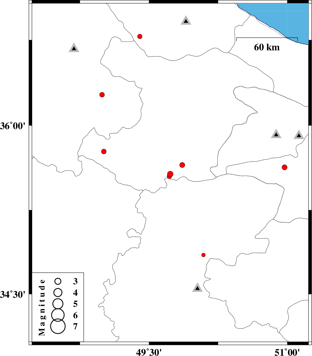
| Prel. Rep. | Date | Time(UTC) | Time(Local) | Lat. | Lon. | Depth | Mag. | Region | Waveform |
| 2013/04/02 | 16:10:41.2 | 20:40:41.2 | 35.57 | 49.73 | 15 | ML:2.8 | Ghazvin Province, 55 km South of Takestan | ||
| 2013/03/20 | 23:07:24.6 | 02:37:24.6 | 35.63 | 50.97 | 16 | ML:2.5 | Tehran Province, 9 km Shahriyar | ||
| 2013/03/19 | 01:50:39.3 | 05:20:39.3 | 36.27 | 48.99 | 14 | ML:2.4 | Zanjan Province, 19 km West of Khoramdareh | ||
| 2013/03/16 | 22:47:51.9 | 02:17:51.9 | 34.85 | 50.09 | 22 | ML:1.9 | Markazi Province, 19 km North of Tafresh | ||
| 2013/03/13 | 12:30:27.6 | 16:00:27.6 | 35.65 | 49.86 | 17 | ML:2.5 | Ghazvin Province, 24 km South-West of Buinzara | ||
| 2013/03/11 | 00:13:15.6 | 03:43:15.6 | 35.55 | 49.72 | 17 | ML:2.3 | Ghazvin Province, 57 km South of Takestan | ||
| 2013/03/09 | 09:46:51.3 | 13:16:51.3 | 34.17 | 48.34 | 14 | ML:2.2 | Hamedan Province, 3 km Nahavand | ||
| 2013/03/06 | 05:46:07.2 | 09:16:07.2 | 36.78 | 49.4 | 14 | ML:2.3 | Gilan Province, 5 km Rudbar | ||
| 2013/03/04 | 20:51:39.4 | 00:21:39.4 | 35.77 | 49.01 | 15 | ML:2.4 | Ghazvin Province, 43 km North of Razan |