Home / Recent Earthquakes

| Prel. Rep. | Date | Time(UTC) | Time(Local) | Lat. | Lon. | Depth | Mag. | Region | Waveform |
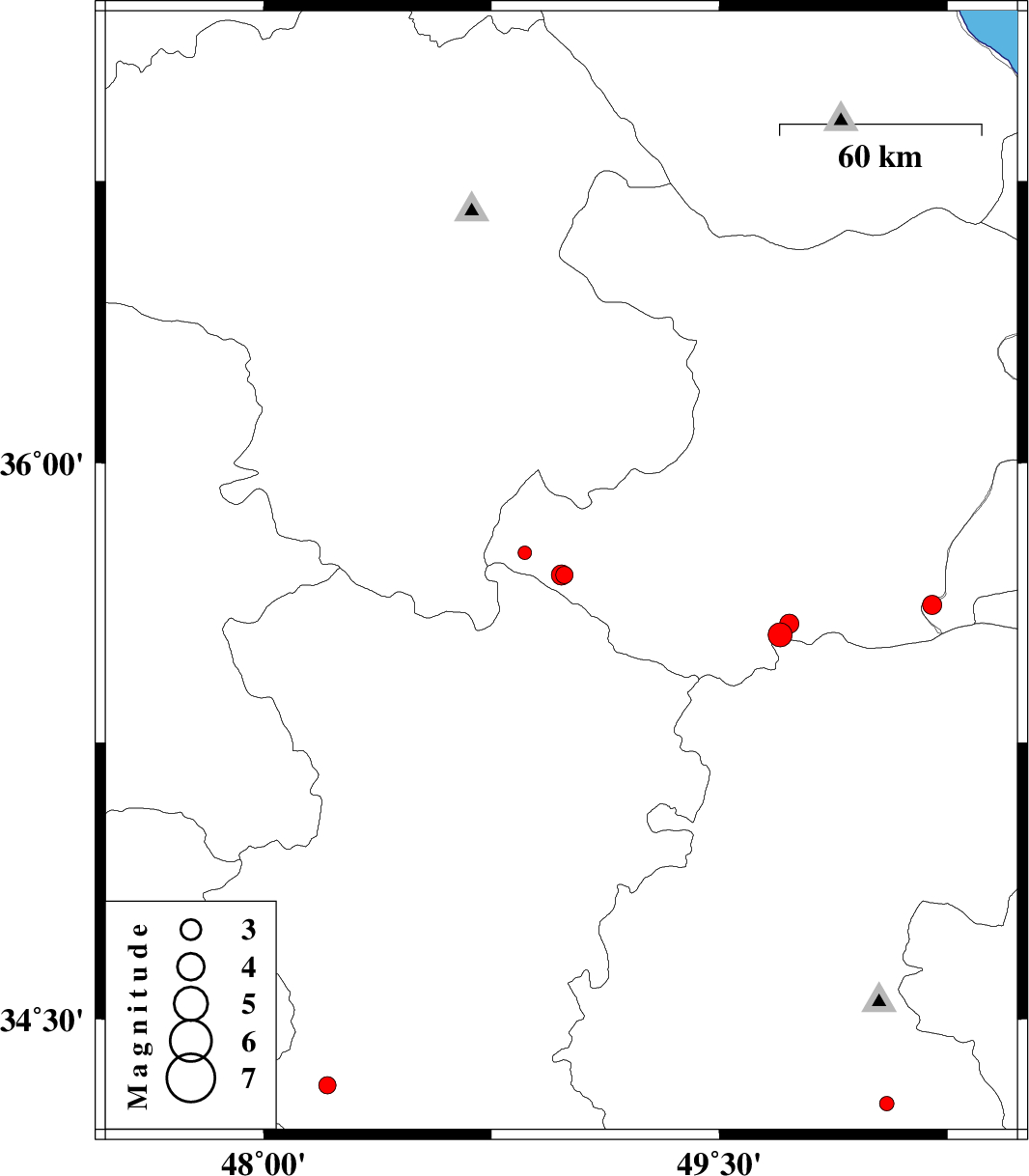
| 2013/04/29 | 06:29:35.7 | 10:59:35.7 | 35.7 | 48.99 | 14 | ML:2.6 | Ghazvin Province, 36 km North of Razan | ||
| 2013/04/29 | 05:56:04.8 | 10:26:04.8 | 35.7 | 48.98 | 14 | ML:2.9 | Ghazvin Province, 36 km North of Razan | ||
| 2013/04/23 | 02:17:23.3 | 06:47:23.3 | 35.62 | 50.2 | 15 | ML:2.8 | Tehran Province, 21 km South-East of Buinzara | ||
| 2013/04/20 | 20:47:27.5 | 01:17:27.5 | 35.76 | 48.86 | 14 | ML:2 | Ghazvin Province, 45 km North-West of Razan | ||
| 2013/04/11 | 21:11:08.1 | 01:41:08.1 | 34.32 | 48.21 | 33 | ML:2.6 | Hamedan Province, 20 km North-West of Nahavand | ||
| 2013/04/07 | 23:06:11.4 | 03:36:11.4 | 35.54 | 49.7 | 15 | ML:3.5 | Ghazvin Province, 58 km South of Takestan | ||
| 2013/04/03 | 22:31:42.9 | 03:01:42.9 | 34.27 | 50.05 | 10 | ML:2.1 | Markazi Province, 29 km South of Ashtiyan | ||
| 2013/04/02 | 16:10:41.2 | 20:40:41.2 | 35.57 | 49.73 | 15 | ML:2.8 | Ghazvin Province, 55 km South of Takestan |