Home / Recent Earthquakes

| Prel. Rep. | Date | Time(UTC) | Time(Local) | Lat. | Lon. | Depth | Mag. | Region | Waveform |
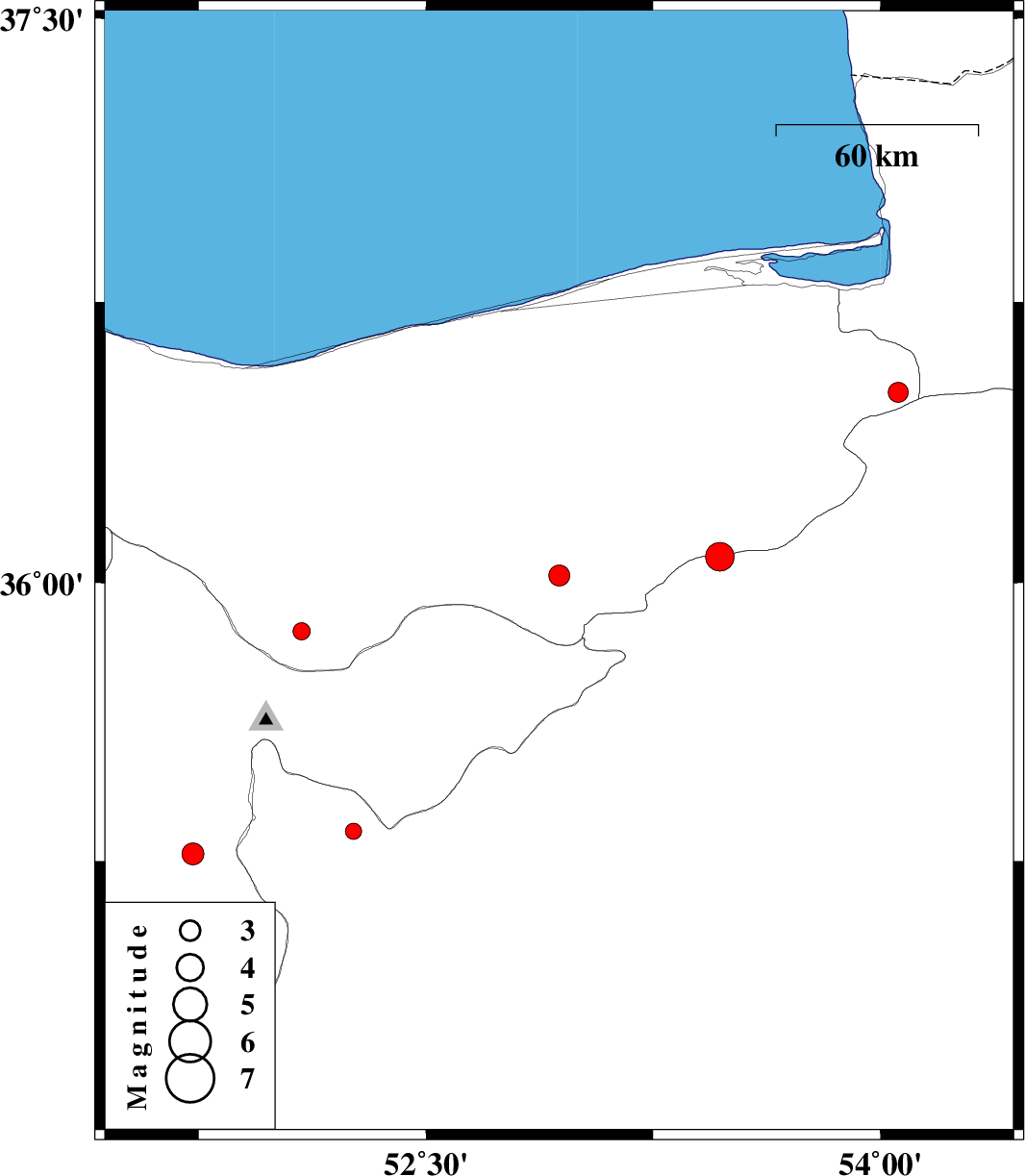
| 2013/07/24 | 16:51:55.2 | 21:21:55.2 | 36.07 | 53.47 | 18 | ML:4.3 | Semnan Province, 38 km East of Pol-E-Sefid | ||
| 2013/07/24 | 08:04:53.1 | 12:34:53.1 | 36.02 | 52.94 | 14 | ML:3.1 | Mazandaran Province, 15 km West of Pol-E-Sefid | ||
| 2013/07/24 | 00:04:06.1 | 04:34:06.1 | 35.27 | 51.73 | 14 | ML:3.2 | Tehran Province, 8 km Varamin | ||
| 2013/07/23 | 06:21:50.8 | 10:51:50.8 | 35.33 | 52.26 | 27 | ML:2.4 | Semnan Province, 15 km North of Garmsar | ||
| 2013/07/20 | 10:21:42.8 | 14:51:42.8 | 36.51 | 54.06 | 18 | ML:2.9 | Mazandaran Province, 32 km South of Kordkuy | ||
| 2013/07/17 | 20:00:30.9 | 00:30:30.9 | 35.87 | 52.09 | 7 | ML:2.5 | Mazandaran Province, 17 km North of Damavand |