Home / Recent Earthquakes

| Prel. Rep. | Date | Time(UTC) | Time(Local) | Lat. | Lon. | Depth | Mag. | Region | Waveform |
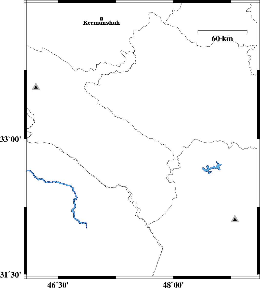
| 2013/12/28 | 22:56:33.9 | 02:26:33.9 | 32.98 | 47.59 | 14 | ML:4.7 | Ilam Province, 13 km East of Abdanan | ||
| 2013/12/28 | 18:55:36.5 | 22:25:36.5 | 32.58 | 48.67 | 14 | ML:2.5 | Khoozestan Province, 33 km North-East of Andimeshk | ||
| 2013/12/16 | 08:52:07.9 | 12:22:07.9 | 33.57 | 47.03 | 15 | ML:3.5 | Lorestan Province, 55 km West of Kuhdasht | ||
| 2013/12/12 | 03:15:45.1 | 06:45:45.1 | 33.61 | 49.01 | 14 | ML:2.4 | Lorestan Province, 16 km North of Dorud | ||
| 2013/12/10 | 15:26:55.2 | 18:56:55.2 | 31.8 | 48.52 | 14 | ML:3.1 | Khoozestan Province, 41 km South-West of Shushtar | ||
| 2013/12/05 | 12:59:50.4 | 16:29:50.4 | 32.23 | 48.59 | 18 | ML:3 | Khoozestan Province, 24 km South-East of Dezful | ||
| 2013/12/01 | 18:45:55.2 | 22:15:55.2 | 34.08 | 46.4 | 18 | ML:3.6 | Kermanshah Province, 19 km West of Eslam Abad-E-Gharb |