| Prel. Rep. | Date | Time(UTC) | Time(Local) | Lat. | Lon. | Depth | Mag. | Region | Waveform |
|
|
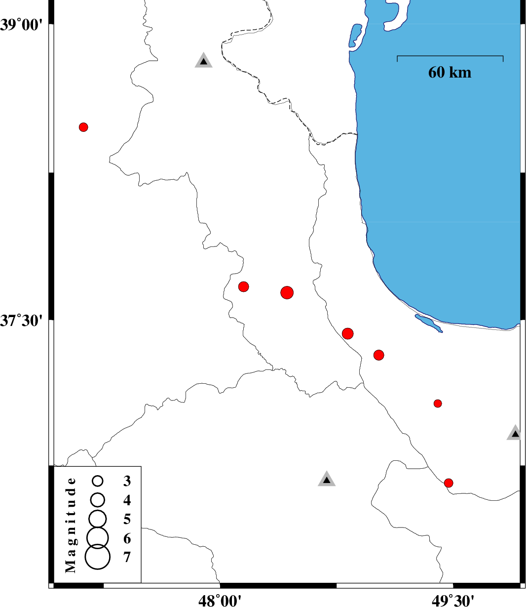
2015/05/09
|
21:13:05.6
|
01:43:05.6
| 37.64 | 48.43 | 6 |
ML:3.6
|
Ardebil Province, 7 km Givi | |
|
|
2015/04/19
|
02:30:02.7
|
07:00:02.7
| 37.32 | 49.02 | 14 |
ML:3
|
Gilan Province, 17 km South-West of Masal | |
|
|
2015/04/18
|
23:40:59.0
|
04:10:59.0
| 37.07 | 49.4 | 15 |
ML:2.3
|
Gilan Province, 11 km Shaft | |
|
|
2015/04/16
|
01:10:35.2
|
05:40:35.2
| 37.43 | 48.82 | 14 |
ML:3.3
|
Gilan Province, 31 km West of Masal | |
|
|
2015/04/15
|
02:02:57.9
|
06:32:57.9
| 37.67 | 48.15 | 14 |
ML:2.9
|
Ardebil Province, 21 km West of Givi | |
|
|
2015/04/14
|
09:53:08.6
|
14:23:08.6
| 36.66 | 49.47 | 14 |
ML:2.5
|
Gilan Province, 18 km South of Rudbar | |
|
|
2015/04/10
|
20:56:11.0
|
01:26:11.0
| 38.48 | 47.12 | 14 |
ML:2.6
|
Azarbaijan Sharghi Province, 3 km Ahar | |