Home / Recent Earthquakes

| Prel. Rep. | Date | Time(UTC) | Time(Local) | Lat. | Lon. | Depth | Mag. | Region | Waveform |
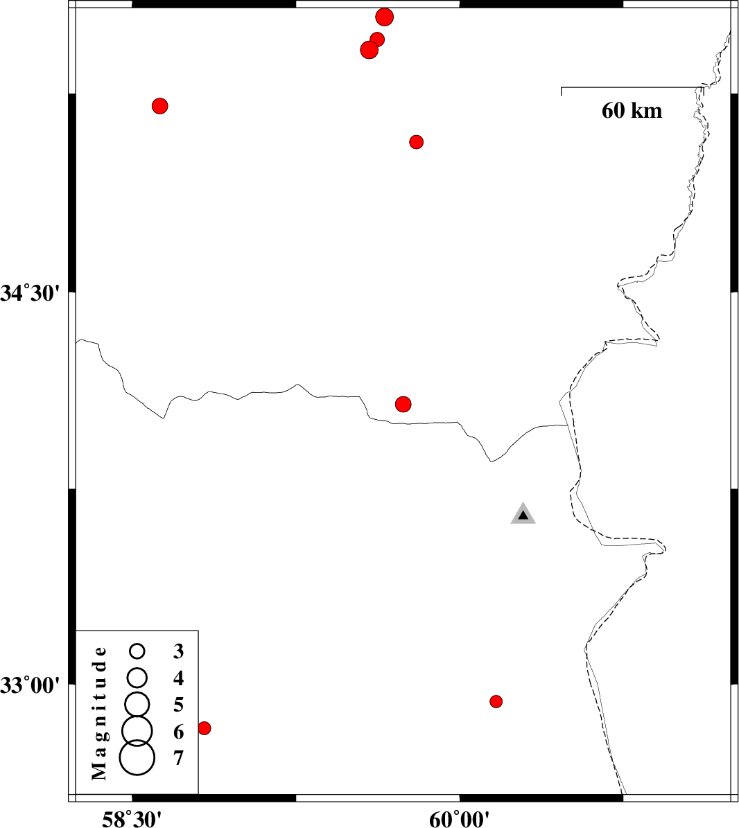
| 2017/04/29 | 17:31:14.6 | 22:01:14.6 | 34.073 | 59.741 | 12 | ML:3.3 | Khorasan(center) Province, 62 km North-East of Qaen | ||
| 2017/04/29 | 10:13:29.6 | 14:43:29.6 | 32.933 | 60.167 | 14 | ML:2.5 | Khorasan(south) Province, 49 km North-East of Sarbisheh | ||
| 2017/04/22 | 09:22:40.4 | 13:52:40.4 | 35.538 | 59.655 | 15 | ML:3.6 | Khorasan(center) Province, 25 km South-West of Fariman | ||
| 2017/04/22 | 09:19:13.0 | 13:49:13.0 | 35.414 | 59.585 | 15 | ML:3.6 | Khorasan(center) Province, 37 km North-East of Torbat-e heydariyeh | ||
| 2017/04/17 | 07:26:24.2 | 11:56:24.2 | 35.453 | 59.622 | 18 | ML:2.9 | Khorasan(center) Province, 34 km South-West of Fariman | ||
| 2017/04/15 | 22:28:17.8 | 02:58:17.8 | 35.068 | 59.802 | 17 | ML:2.8 | Khorasan(center) Province, 71 km South of Fariman | ||
| 2017/04/13 | 15:29:10.2 | 19:59:10.2 | 35.203 | 58.627 | 15 | ML:3.2 | Khorasan(center) Province, 16 km -East of Kashmar | ||
| 2017/04/04 | 08:06:23.5 | 12:36:23.5 | 32.83 | 58.83 | 16 | ML:2.7 | Khorasan(south) Province, 38 km -West of Birjand |