Home / Recent Earthquakes

| Prel. Rep. | Date | Time(UTC) | Time(Local) | Lat. | Lon. | Depth | Mag. | Region | Waveform |
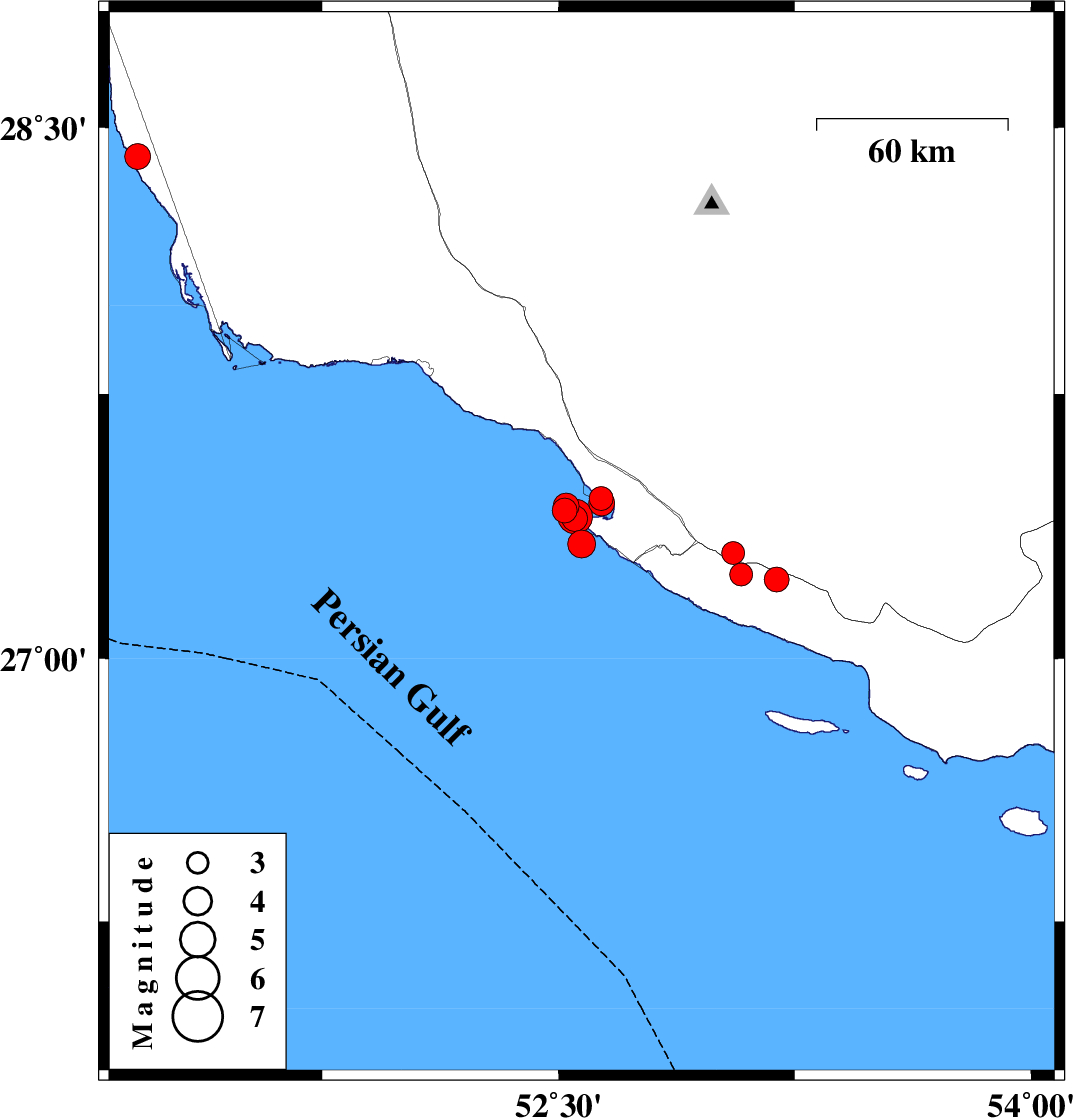
| 2025/07/27 | 09:16:14.6 | 12:46:14.6 | 27.454 | 52.635 | 12 | ML:3.4 | , 27 km -West of Mehr | ||
| 2025/07/27 | 08:30:26.5 | 12:00:26.5 | 27.325 | 52.573 | 12 | ML:4 | Persian Gulf, 40 km South-West of Mehr | ||
| 2025/07/27 | 07:05:02.8 | 10:35:02.8 | 27.42 | 52.52 | 16 | ML:3.5 | Persian Gulf, 39 km South-West of Mehr | ||
| 2025/07/27 | 00:52:49.8 | 04:22:49.8 | 27.3 | 53.054 | 12 | ML:3.3 | Fars Province, 12 km -West of Lamerd | ||
| 2025/07/26 | 22:46:51.7 | 02:16:51.7 | 27.238 | 53.079 | 12 | ML:3.3 | Hormozgan Province, 14 km of Lamerd | ||
| 2025/07/26 | 19:39:25.0 | 23:09:25.0 | 27.224 | 53.193 | 12 | ML:3.5 | Hormozgan Province, 12 km South of Lamerd | ||
| 2025/07/26 | 16:35:39.1 | 20:05:39.1 | 27.442 | 52.636 | 12 | ML:3.7 | , 27 km South-West of Mehr | ||
| 2025/07/26 | 15:51:59.5 | 19:21:59.5 | 27.433 | 52.524 | 12 | ML:3.6 | Persian Gulf, 38 km South-West of Mehr | ||
| 2025/07/26 | 10:55:28.1 | 14:25:28.1 | 27.398 | 52.551 | 12 | ML:3.7 | Persian Gulf, 37 km South-West of Mehr | ||
| 2025/07/26 | 10:10:02.4 | 13:40:02.4 | 27.403 | 52.552 | 12 | ML:4.9 | Persian Gulf, 37 km South-West of Mehr | ||
| 2025/07/25 | 04:51:14.8 | 08:21:14.8 | 28.418 | 51.164 | 12 | ML:3.6 | Bushehr Province, 33 km South-West of Khormog |