
| Prel. Rep. | Date | Time(UTC) | Time(Local) | Lat. | Lon. | Depth | Mag. | Region | Waveform |
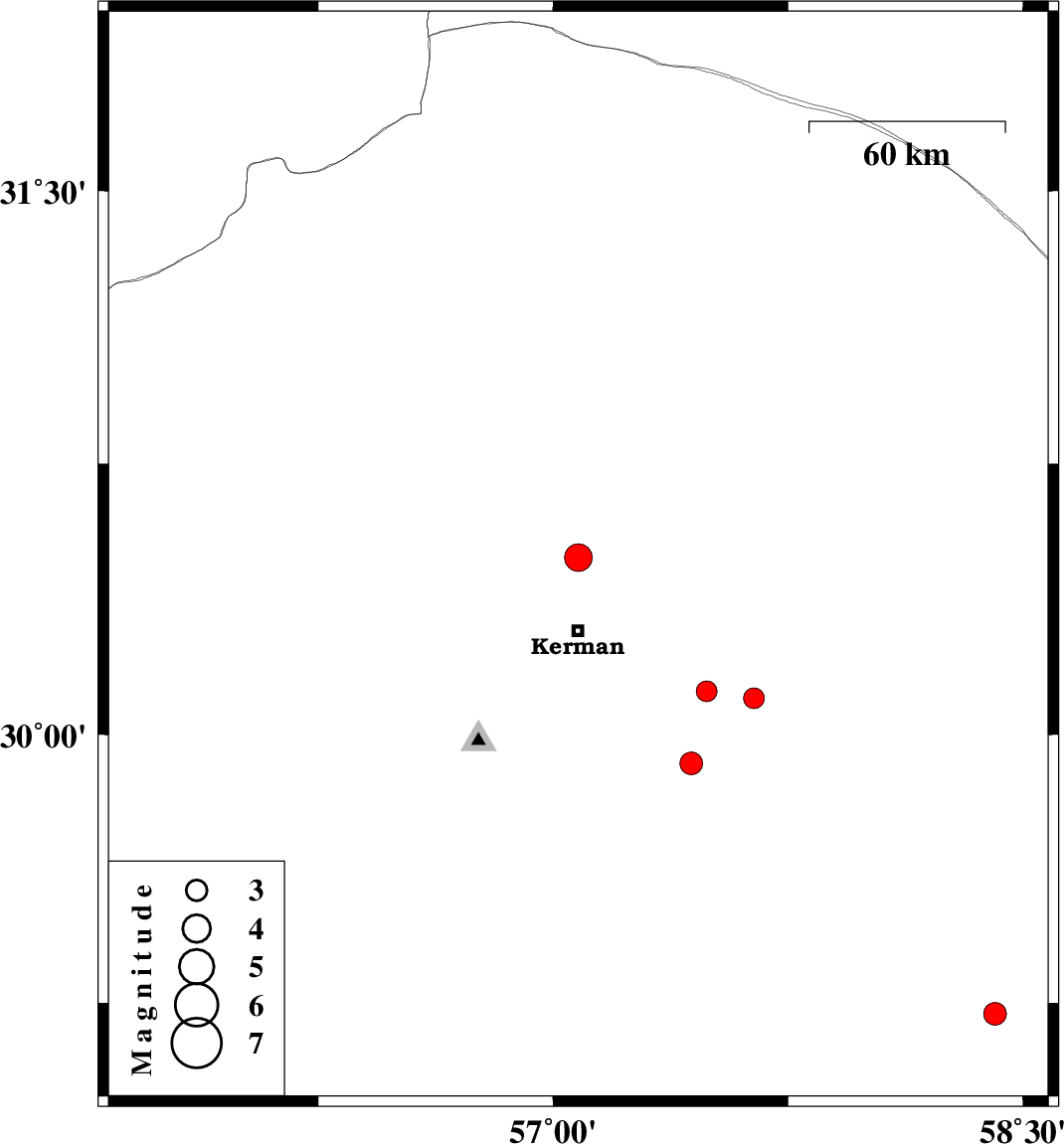
| 2008/05/27 | 17:07:21.5 | 21:37:21.5 | 30.49 | 57.08 | 14 | ML:4 | 22 km North of Kerman, Kerman Province | ||
| 2008/05/24 | 05:21:35.8 | 09:51:35.8 | 29.22 | 58.41 | 14 | ML:3.2 | 13 km North of Bam, Kerman Province | ||
| 2008/05/21 | 03:22:25.8 | 07:52:25.8 | 30.12 | 57.49 | 14 | ML:3 | 43 km South-East of Kerman, Kerman Province | ||
| 2008/05/21 | 00:59:49.9 | 05:29:49.9 | 30.1 | 57.64 | 14 | ML:3 | 57 km South-East of Kerman, Kerman Province | ||
| 2008/05/04 | 08:16:34.8 | 12:46:34.8 | 29.92 | 57.44 | 2 | ML:3.2 | 53 km South-East of Kerman, Kerman Province |