| Prel. Rep. | Date | Time(UTC) | Time(Local) | Lat. | Lon. | Depth | Mag. | Region | Waveform |
|
|
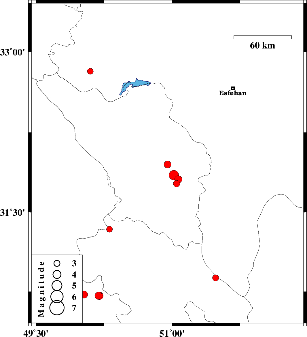
2013/01/14
|
02:26:29.8
|
05:56:29.8
| 31.95 | 50.95 | 18 |
ML:3.5
|
Chaharmahal Bakhtiari Province, 28 km East of Ardel | |
|
|
2013/01/12
|
06:29:02.5
|
09:59:02.5
| 31.77 | 51.05 | 46 |
ML:3.3
|
Chaharmahal Bakhtiari Province, 31 km South-West of Borujen | |
|
|
2013/01/12
|
03:33:21.4
|
07:03:21.4
| 31.81 | 51.07 | 14 |
ML:3.7
|
Chaharmahal Bakhtiari Province, 27 km South-West of Borujen | |
|
|
2013/01/12
|
03:25:05.8
|
06:55:05.8
| 31.85 | 51.02 | 14 |
ML:4.8
|
Chaharmahal Bakhtiari Province, 29 km South-West of Borujen | |
|
|
2013/01/10
|
18:32:55.4
|
22:02:55.4
| 32.82 | 50.1 | 17 |
ML:3
|
Esfahan Province, 13 km South of Fereydunshahr | |
|
|
2013/01/07
|
03:38:18.6
|
07:08:18.6
| 30.71 | 50.19 | 15 |
ML:3.6
|
Khoozestan Province, 13 km North of Behbahan | |
|
|
2013/01/03
|
18:25:18.5
|
21:55:18.5
| 30.71 | 50.2 | 32 |
ML:3.8
|
Khoozestan Province, 14 km North of Behbahan | |
|
|
2012/12/26
|
01:26:42.8
|
04:56:42.8
| 30.72 | 50.03 | 38 |
ML:3.7
|
Khoozestan Province, 25 km North-West of Behbahan | |
|
|
2012/12/20
|
18:47:17.7
|
22:17:17.7
| 30.88 | 51.48 | 15 |
ML:3.1
|
Kohkiluieh va boyerahmad Province, 2 km Sisakht | |
|
|
2012/12/16
|
10:09:57.7
|
13:39:57.7
| 31.34 | 50.31 | 14 |
ML:3
|
Kohkiluieh va boyerahmad Province, 44 km South-East of Bagh Malek | |