Home / Recent Earthquakes

| Prel. Rep. | Date | Time(UTC) | Time(Local) | Lat. | Lon. | Depth | Mag. | Region | Waveform |
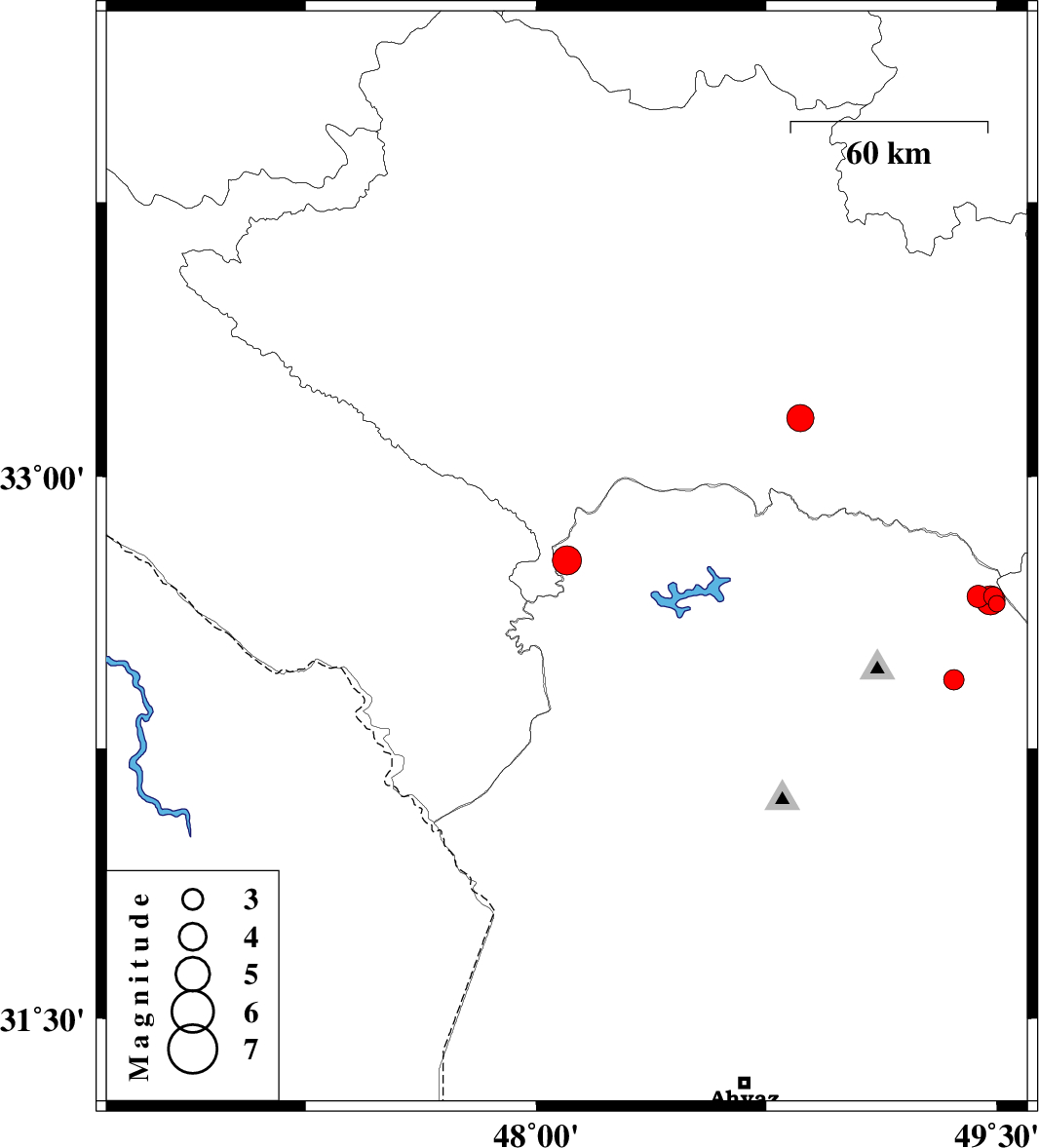
| 2013/09/23 | 01:41:36.7 | 05:11:36.7 | 32.77 | 48.1 | 15 | ML:4.3 | Khoozestan Province, 42 km North-West of Andimeshk | ||
| 2013/09/20 | 05:11:59.5 | 09:41:59.5 | 32.44 | 49.36 | 14 | ML:2.9 | Khoozestan Province, 24 km East of Lali | ||
| 2013/09/18 | 16:26:52.0 | 20:56:52.0 | 33.16 | 48.86 | 18 | ML:4 | Lorestan Province, 41 km South-West of Dorud | ||
| 2013/09/16 | 18:19:09.3 | 22:49:09.3 | 32.65 | 49.5 | 18 | ML:2.4 | Khoozestan Province, 47 km North-East of Lali | ||
| 2013/09/16 | 17:05:11.0 | 21:35:11.0 | 32.67 | 49.49 | 14 | ML:2.8 | Khoozestan Province, 47 km North-East of Lali | ||
| 2013/09/16 | 16:08:19.0 | 20:38:19.0 | 32.67 | 49.44 | 14 | ML:3.3 | Khoozestan Province, 44 km North-East of Lali | ||
| 2013/09/16 | 16:05:04.3 | 20:35:04.3 | 32.66 | 49.48 | 15 | ML:4.3 | Khoozestan Province, 46 km North-East of Lali |