Home / Recent Earthquakes

| Prel. Rep. | Date | Time(UTC) | Time(Local) | Lat. | Lon. | Depth | Mag. | Region | Waveform |
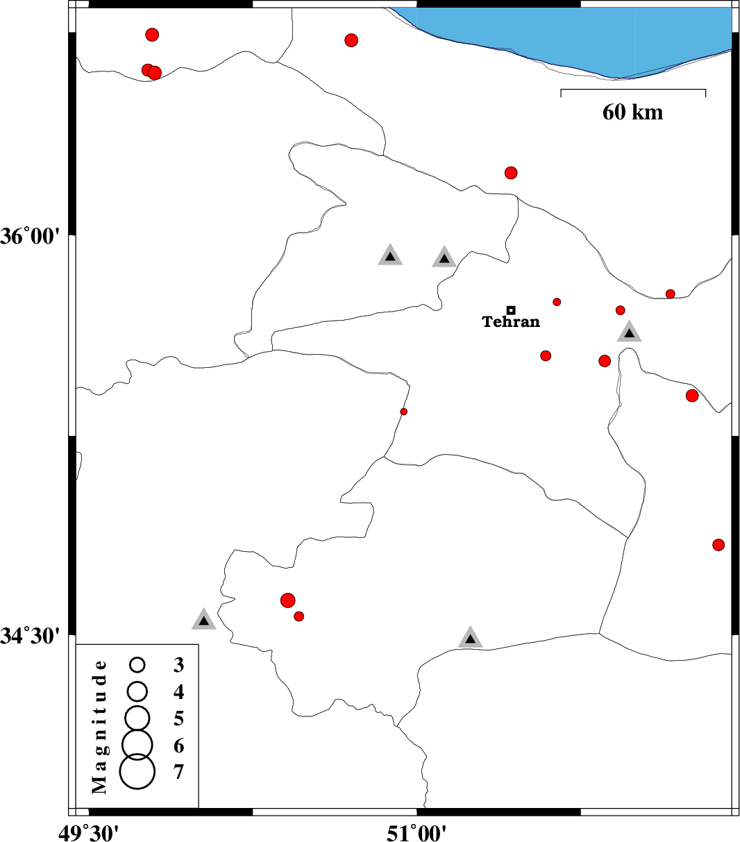
| 2013/12/27 | 23:10:23.6 | 02:40:23.6 | 35.34 | 50.94 | 27 | ML:1.4 | Markazi Province, 20 km South-West of Robatkarim | ||
| 2013/12/27 | 14:49:48.4 | 18:19:48.4 | 35.72 | 51.93 | 10 | ML:1.8 | Tehran Province, 12 km West of Damavand | ||
| 2013/12/27 | 12:48:17.1 | 16:18:17.1 | 35.78 | 52.16 | 14 | ML:1.9 | Mazandaran Province, 11 km Damavand | ||
| 2013/12/25 | 09:30:58.7 | 13:00:58.7 | 35.4 | 52.26 | 20 | ML:2.5 | Semnan Province, 22 km North of Garmsar | ||
| 2013/12/18 | 08:01:56.6 | 11:31:56.6 | 34.84 | 52.38 | 14 | ML:2.4 | Semnan Province, 43 km South of Garmsar | ||
| 2013/12/17 | 15:49:32.8 | 19:19:32.8 | 36.74 | 49.79 | 14 | ML:2.7 | Gilan Province, 34 km East of Rudbar | ||
| 2013/12/14 | 06:36:47.2 | 10:06:47.2 | 35.55 | 51.59 | 15 | ML:2.1 | Tehran Province, 11 km Pakdasht | ||
| 2013/12/12 | 09:12:20.6 | 12:42:20.6 | 35.75 | 51.64 | 36 | ML:1.6 | Tehran Province, 19 km East of Tajrish | ||
| 2013/12/12 | 06:18:05.9 | 09:48:05.9 | 36.23 | 51.43 | 14 | ML:2.5 | Mazandaran Province, 48 km South of Chalus | ||
| 2013/12/06 | 12:09:28.0 | 15:39:28.0 | 36.6 | 49.8 | 14 | ML:2.8 | Gilan Province, 41 km North-West of Qazvin | ||
| 2013/12/06 | 11:32:26.6 | 15:02:26.6 | 36.61 | 49.77 | 18 | ML:2.5 | Gilan Province, 39 km South-East of Rudbar | ||
| 2013/12/03 | 19:56:05.8 | 23:26:05.8 | 34.57 | 50.46 | 14 | ML:2 | Qom Province, 38 km West of Qom | ||
| 2013/12/03 | 19:50:38.2 | 23:20:38.2 | 34.63 | 50.41 | 20 | ML:3 | Qom Province, 44 km South of Saveh | ||
| 2013/11/29 | 23:36:39.0 | 03:06:39.0 | 36.72 | 50.7 | 14 | ML:2.7 | Mazandaran Province, 21 km South of Ramsar | ||
| 2013/11/28 | 00:54:25.6 | 04:24:25.6 | 35.53 | 51.86 | 17 | ML:2.4 | Tehran Province, 18 km East of Pakdasht |