
| Prel. Rep. | Date | Time(UTC) | Time(Local) | Lat. | Lon. | Depth | Mag. | Region | Waveform |
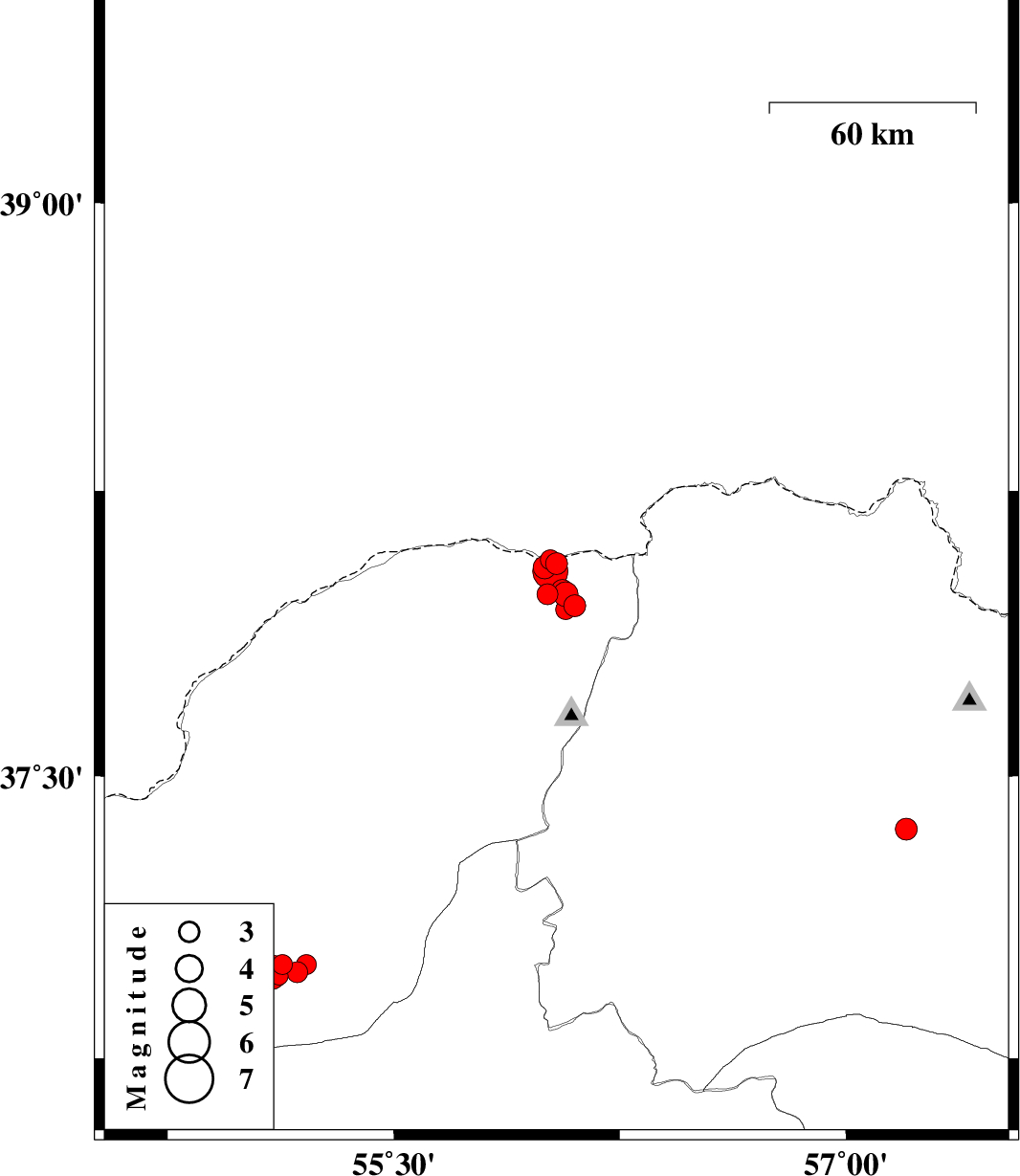
| 2020/10/04 | 18:14:15.1 | 21:44:15.1 | 38.06 | 56.04 | 10 | ML:3.2 | Golestan Province, 90 km North-East of Kalaleh | ||
| 2020/09/30 | 04:47:11.3 | 08:17:11.3 | 37.95 | 56.1 | 10 | ML:3.2 | Golestan Province, 83 km North-East of Kalaleh | ||
| 2020/09/29 | 04:36:35.8 | 08:06:35.8 | 38.07 | 56.02 | 10 | ML:3 | Golestan Province, 90 km North-East of Kalaleh | ||
| 2020/09/28 | 20:08:30.2 | 23:38:30.2 | 37.98 | 56.01 | 10 | ML:3.1 | Golestan Province, 81 km North-East of Kalaleh | ||
| 2020/09/26 | 21:42:49.9 | 01:12:49.9 | 38.05 | 56 | 10 | ML:3.4 | Golestan Province, 87 km North-East of Kalaleh | ||
| 2020/09/26 | 17:15:23.5 | 20:45:23.5 | 37.98 | 56.07 | 10 | ML:3.6 | Golestan Province, 84 km North-East of Kalaleh | ||
| 2020/09/26 | 07:17:18.1 | 10:47:18.1 | 37.94 | 56.07 | 10 | ML:3 | Golestan Province, 80 km North-East of Kalaleh | ||
| 2020/09/26 | 06:35:16.4 | 10:05:16.4 | 37.99 | 56.06 | 10 | ML:3.2 | Golestan Province, 84 km North-East of Kalaleh | ||
| 2020/09/26 | 05:46:54.2 | 09:16:54.2 | 38.04 | 56.02 | 10 | ML:5.2 | Golestan Province, 87 km North-East of Kalaleh | ||
| 2020/09/20 | 08:50:17.4 | 13:20:17.4 | 37.36 | 57.2 | 10 | ML:3.2 | Khorasan(north) Province, 17 km South-West of Bojnurd | ||
| 2020/09/08 | 04:24:32.2 | 08:54:32.2 | 37 | 55.13 | 10 | ML:3 | Golestan Province, 2 km of Ramian | ||
| 2020/09/07 | 16:50:16.9 | 21:20:16.9 | 36.97 | 55.12 | 10 | ML:2.7 | Golestan Province, 5 km of Ramian | ||
| 2020/09/07 | 13:40:25.5 | 18:10:25.5 | 36.98 | 55.18 | 10 | ML:3.1 | Golestan Province, 5 km of Ramian | ||
| 2020/09/07 | 05:53:37.2 | 10:23:37.2 | 37 | 55.21 | 10 | ML:3 | Golestan Province, 6 km of Ramian | ||
| 2020/09/06 | 21:34:24.0 | 02:04:24.0 | 36.98 | 55.09 | 10 | Mb:5.2 | Golestan Province, 6 km of Ramian |

 IIEES All Rights Reserved