| Prel. Rep. | Date | Time(UTC) | Time(Local) | Lat. | Lon. | Depth | Mag. | Region | Waveform |
|
|
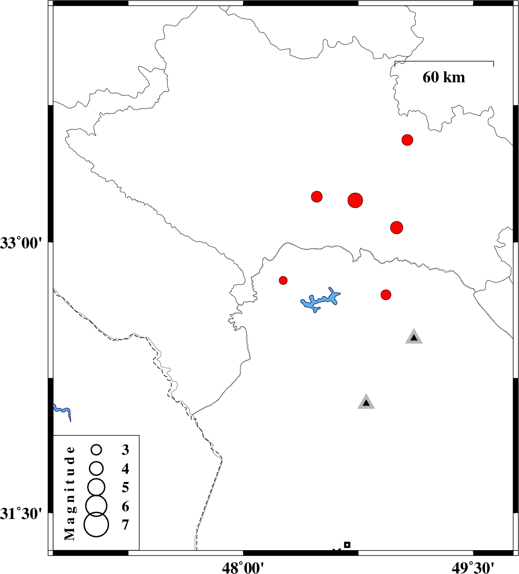
2013/02/02
|
23:20:26.5
|
02:50:26.5
| 32.79 | 48.26 | 14 |
ML:2.4
|
Khoozestan Province, 38 km North of Andimeshk | |
|
|
2013/01/24
|
03:09:22.0
|
06:39:22.0
| 33.25 | 48.48 | 18 |
ML:3.2
|
Lorestan Province, 28 km South-East of Khorramabad | |
|
|
2013/01/22
|
11:12:17.3
|
14:42:17.3
| 33.23 | 48.73 | 15 |
ML:4.4
|
Lorestan Province, 42 km South-West of Dorud | |
|
|
2013/01/16
|
15:19:41.8
|
18:49:41.8
| 33.56 | 49.07 | 16 |
ML:3.3
|
Lorestan Province, 9 km Dorud | |
|
|
2013/01/13
|
09:07:45.6
|
12:37:45.6
| 32.71 | 48.93 | 14 |
ML:3
|
Khoozestan Province, 39 km North-West of Lali | |
|
|
2013/01/07
|
13:18:19.8
|
16:48:19.8
| 33.08 | 49 | 14 |
ML:3.6
|
Lorestan Province, 45 km South of Dorud | |