
| Prel. Rep. | Date | Time(UTC) | Time(Local) | Lat. | Lon. | Depth | Mag. | Region | Waveform |
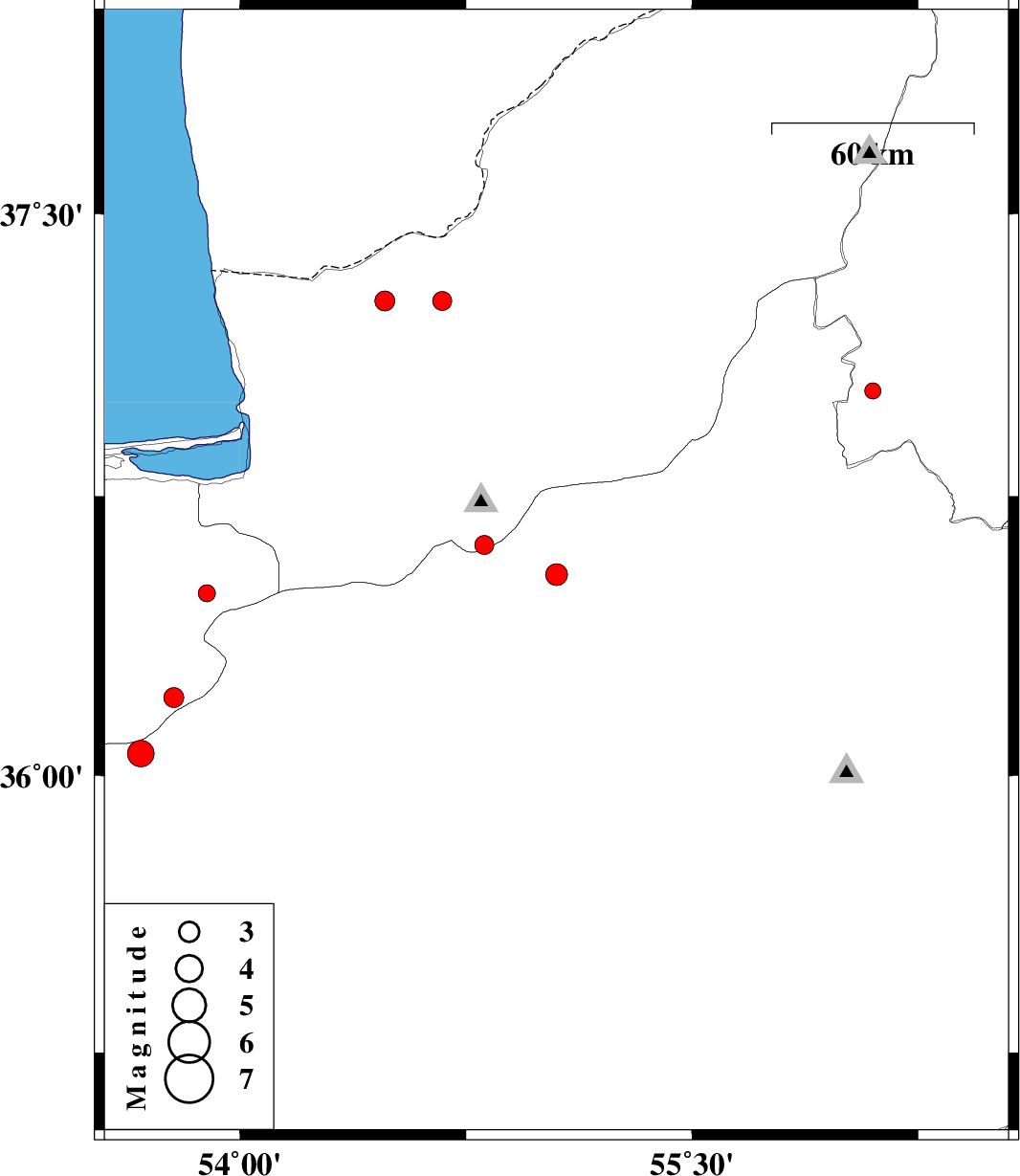
| 2013/05/09 | 21:10:06.3 | 01:40:06.3 | 36.54 | 55.05 | 14 | ML:3.2 | Semnan Province, 15 km North of Shahrud | ||
| 2013/05/02 | 19:45:07.3 | 00:15:07.3 | 36.49 | 53.89 | 45 | ML:2.6 | Mazandaran Province, 31 km South of Bandar-e gaz | ||
| 2013/04/24 | 02:47:56.1 | 07:17:56.1 | 36.21 | 53.78 | 18 | ML:3 | Mazandaran Province, 51 km West of Damghan | ||
| 2013/04/21 | 16:28:47.0 | 20:58:47.0 | 37.27 | 54.67 | 14 | ML:2.8 | Golestan Province, 35 km North-East of Aq Qaleh | ||
| 2013/04/20 | 15:32:56.7 | 20:02:56.7 | 37.03 | 56.1 | 26 | ML:2.4 | Khorasan(north) Province, 27 km West of Jajarm | ||
| 2013/04/14 | 14:04:30.8 | 18:34:30.8 | 36.62 | 54.81 | 14 | ML:2.8 | Golestan Province, 33 km South of Ali Abad | ||
| 2013/04/10 | 01:29:36.8 | 05:59:36.8 | 36.06 | 53.67 | 15 | ML:3.9 | Semnan Province, 55 km East of Pol-E-Sefid | ||
| 2013/04/09 | 10:22:49.3 | 14:52:49.3 | 37.27 | 54.48 | 14 | ML:2.9 | Golestan Province, 29 km North of Aq Qaleh |

 IIEES All Rights Reserved