Home / Recent Earthquakes

| Prel. Rep. | Date | Time(UTC) | Time(Local) | Lat. | Lon. | Depth | Mag. | Region | Waveform |
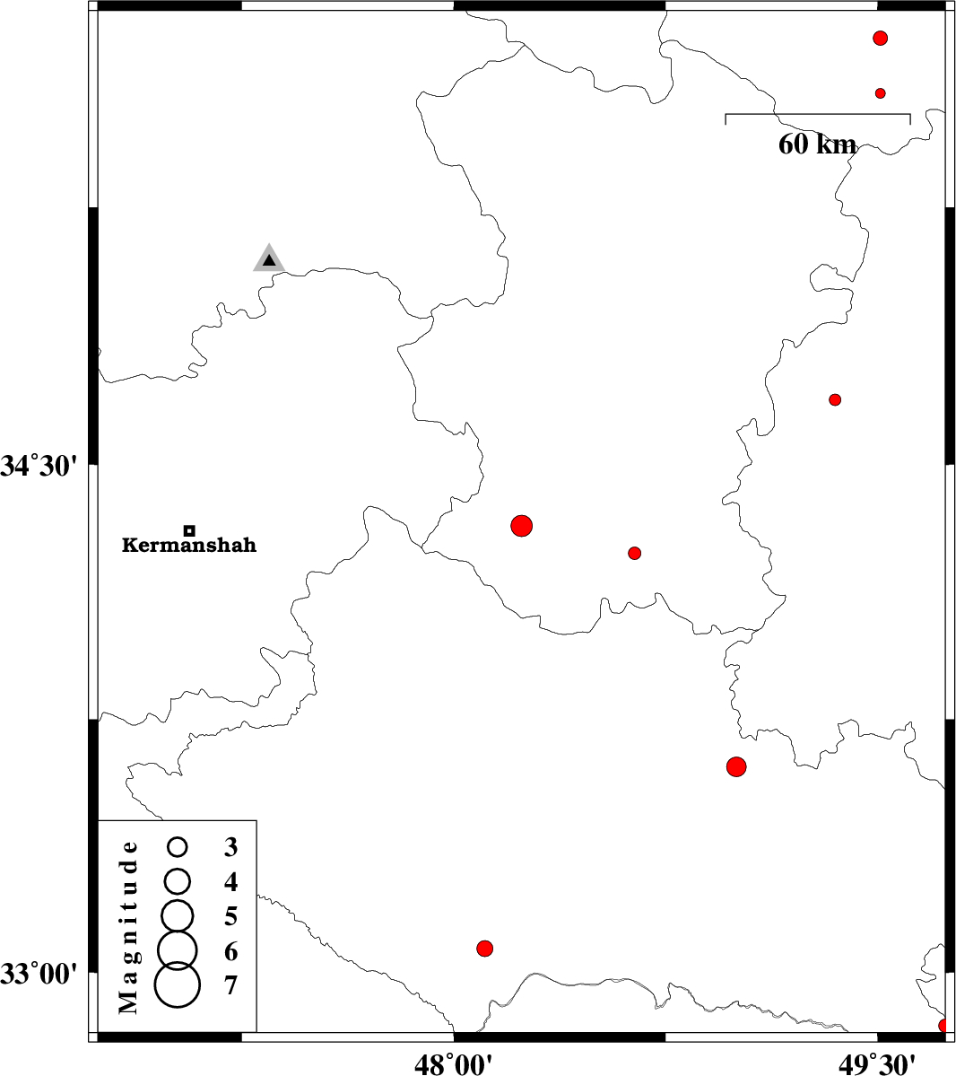
| 2013/06/15 | 05:04:37.2 | 09:34:37.2 | 34.32 | 48.24 | 14 | ML:3.4 | Hamedan Province, 18 km North-West of Nahavand | ||
| 2013/06/14 | 17:59:58.1 | 22:29:58.1 | 33.61 | 49 | 22 | ML:3.1 | Lorestan Province, 16 km North of Dorud | ||
| 2013/06/07 | 00:20:49.0 | 04:50:49.0 | 32.84 | 49.74 | 6 | ML:2.1 | Lorestan Province, 36 km West of Fereydunshahr | ||
| 2013/06/06 | 20:57:16.8 | 01:27:16.8 | 34.24 | 48.64 | 42 | ML:2 | Hamedan Province, 18 km West of Malayer | ||
| 2013/06/04 | 12:58:21.3 | 17:28:21.3 | 33.07 | 48.11 | 14 | ML:2.5 | Lorestan Province, 38 km East of Pol-e dokhtar | ||
| 2013/05/23 | 15:13:34.0 | 19:43:34.0 | 35.58 | 49.51 | 34 | ML:1.6 | Ghazvin Province, 48 km North-East of Razan | ||
| 2013/05/22 | 10:36:26.1 | 15:06:26.1 | 34.69 | 49.35 | 6 | ML:1.9 | Markazi Province, 61 km West of Tafresh | ||
| 2013/05/16 | 15:37:51.8 | 20:07:51.8 | 35.74 | 49.51 | 46 | ML:2.3 | Ghazvin Province, 40 km South-West of Takestan |