Home / Recent Earthquakes

| Prel. Rep. | Date | Time(UTC) | Time(Local) | Lat. | Lon. | Depth | Mag. | Region | Waveform |
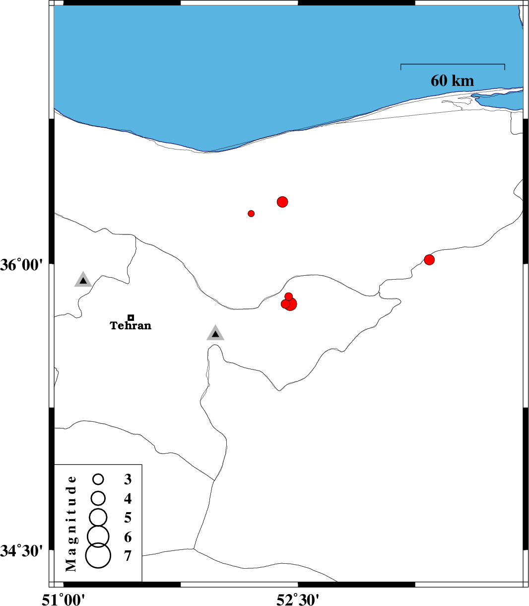
| 2013/06/21 | 22:04:59.7 | 02:34:59.7 | 35.83 | 52.44 | 13 | ML:2.3 | Tehran Province, 31 km West of Firuzkuh | ||
| 2013/06/21 | 19:52:48.4 | 00:22:48.4 | 35.79 | 52.42 | 17 | ML:2.5 | Tehran Province, 32 km West of Firuzkuh | ||
| 2013/06/21 | 05:57:44.0 | 10:27:44.0 | 35.79 | 52.45 | 16 | ML:3.8 | Tehran Province, 29 km West of Firuzkuh | ||
| 2013/06/20 | 11:38:13.4 | 16:08:13.4 | 36.32 | 52.4 | 14 | ML:3.1 | Mazandaran Province, 17 km South of Amol | ||
| 2013/06/16 | 06:10:27.4 | 10:40:27.4 | 36.26 | 52.2 | 7 | ML:1.9 | Mazandaran Province, 27 km South-West of Amol | ||
| 2013/06/15 | 02:34:26.0 | 07:04:26.0 | 36.02 | 53.34 | 15 | ML:3 | Semnan Province, 28 km East of Pol-E-Sefid |