Home / Recent Earthquakes

| Prel. Rep. | Date | Time(UTC) | Time(Local) | Lat. | Lon. | Depth | Mag. | Region | Waveform |
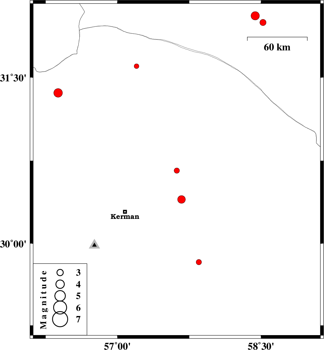
| 2013/08/21 | 01:26:40.3 | 05:56:40.3 | 30.66 | 57.62 | 14 | ML:2.5 | Kerman Province, 66 km North-East of Kerman | ||
| 2013/08/16 | 15:42:50.6 | 20:12:50.6 | 31.99 | 58.52 | 14 | ML:3 | Khorasan(south) Province, 121 km South-West of Birjand | ||
| 2013/08/14 | 16:36:30.6 | 21:06:30.6 | 31.36 | 56.38 | 14 | ML:4.1 | Kerman Province, 42 km West of Ravar | ||
| 2013/08/06 | 03:48:50.9 | 08:18:50.9 | 30.4 | 57.67 | 18 | ML:3.7 | Kerman Province, 58 km North-East of Kerman | ||
| 2013/07/28 | 12:46:44.6 | 17:16:44.6 | 32.05 | 58.44 | 18 | ML:3.9 | Khorasan(south) Province, 120 km South-West of Birjand | ||
| 2013/07/22 | 22:41:33.0 | 03:11:33.0 | 29.83 | 57.85 | 14 | ML:2.6 | Kerman Province, 94 km North-West of Bam | ||
| 2013/07/22 | 18:24:54.1 | 22:54:54.1 | 31.6 | 57.2 | 18 | ML:2.2 | Kerman Province, 52 km North-East of Ravar |