Home / Recent Earthquakes

| Prel. Rep. | Date | Time(UTC) | Time(Local) | Lat. | Lon. | Depth | Mag. | Region | Waveform |
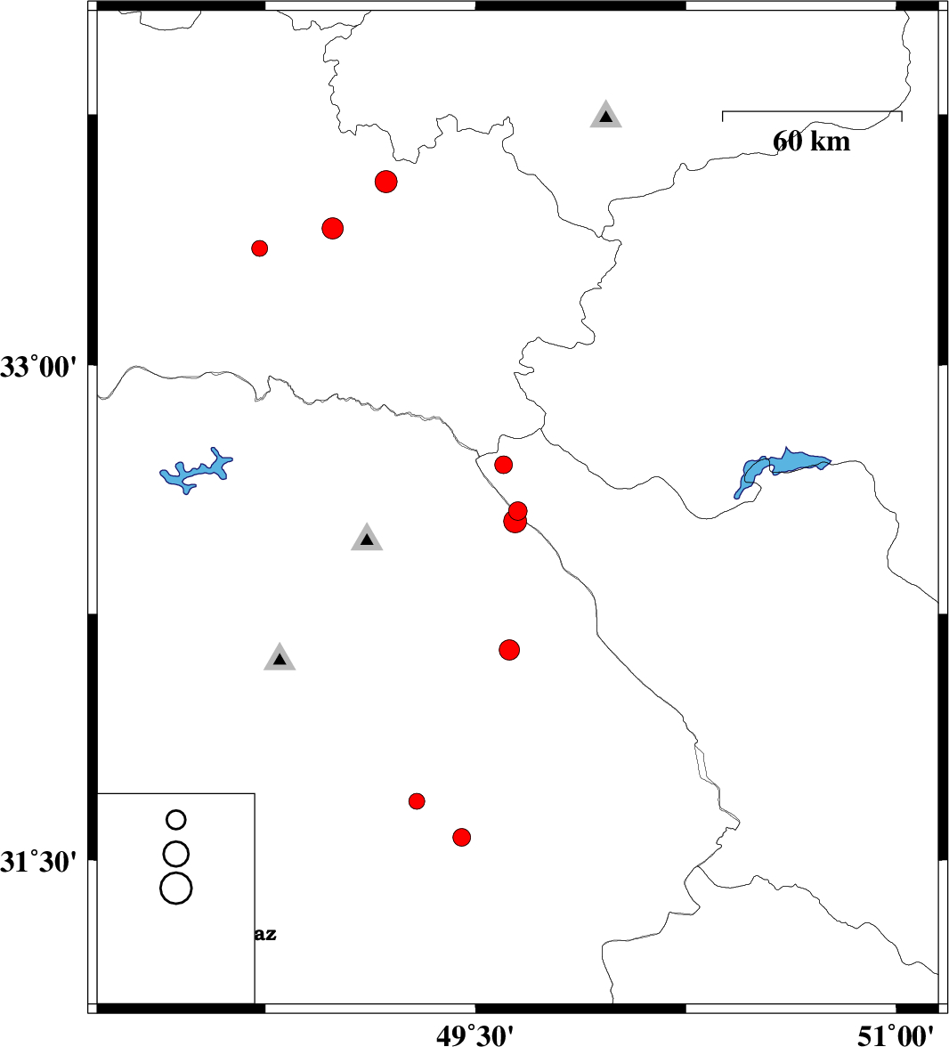
| 2013/09/05 | 20:52:02.7 | 01:22:02.7 | 32.56 | 49.65 | 16 | ML:2.9 | Chaharmahal Bakhtiari Province, 46 km West of Chelgard | ||
| 2013/09/03 | 20:04:58.5 | 00:34:58.5 | 33.55 | 49.18 | 14 | ML:3.5 | Lorestan Province, 12 km East of Dorud | ||
| 2013/08/25 | 00:49:53.8 | 05:19:53.8 | 32.14 | 49.62 | 31 | ML:3.2 | Khoozestan Province, 37 km North-East of Masjed Soleyman | ||
| 2013/08/24 | 04:16:34.5 | 08:46:34.5 | 31.57 | 49.45 | 37 | ML:2.8 | Khoozestan Province, 36 km North-West of Ramhormoz | ||
| 2013/08/24 | 04:11:35.3 | 08:41:35.3 | 31.68 | 49.29 | 18 | ML:2.6 | Khoozestan Province, 28 km South of Masjed Soleyman | ||
| 2013/08/12 | 15:00:08.8 | 19:30:08.8 | 32.53 | 49.64 | 14 | ML:3.6 | Khoozestan Province, 46 km West of Chelgard | ||
| 2013/08/09 | 03:45:31.3 | 08:15:31.3 | 33.35 | 48.73 | 14 | ML:2.6 | Lorestan Province, 35 km South-West of Dorud | ||
| 2013/08/08 | 15:41:25.3 | 20:11:25.3 | 32.7 | 49.6 | 15 | ML:2.8 | Chaharmahal Bakhtiari Province, 55 km North-West of Chelgard | ||
| 2013/08/06 | 12:46:06.8 | 17:16:06.8 | 33.41 | 48.99 | 16 | ML:3.4 | Lorestan Province, 11 km Dorud |