Home / Recent Earthquakes

| Prel. Rep. | Date | Time(UTC) | Time(Local) | Lat. | Lon. | Depth | Mag. | Region | Waveform |
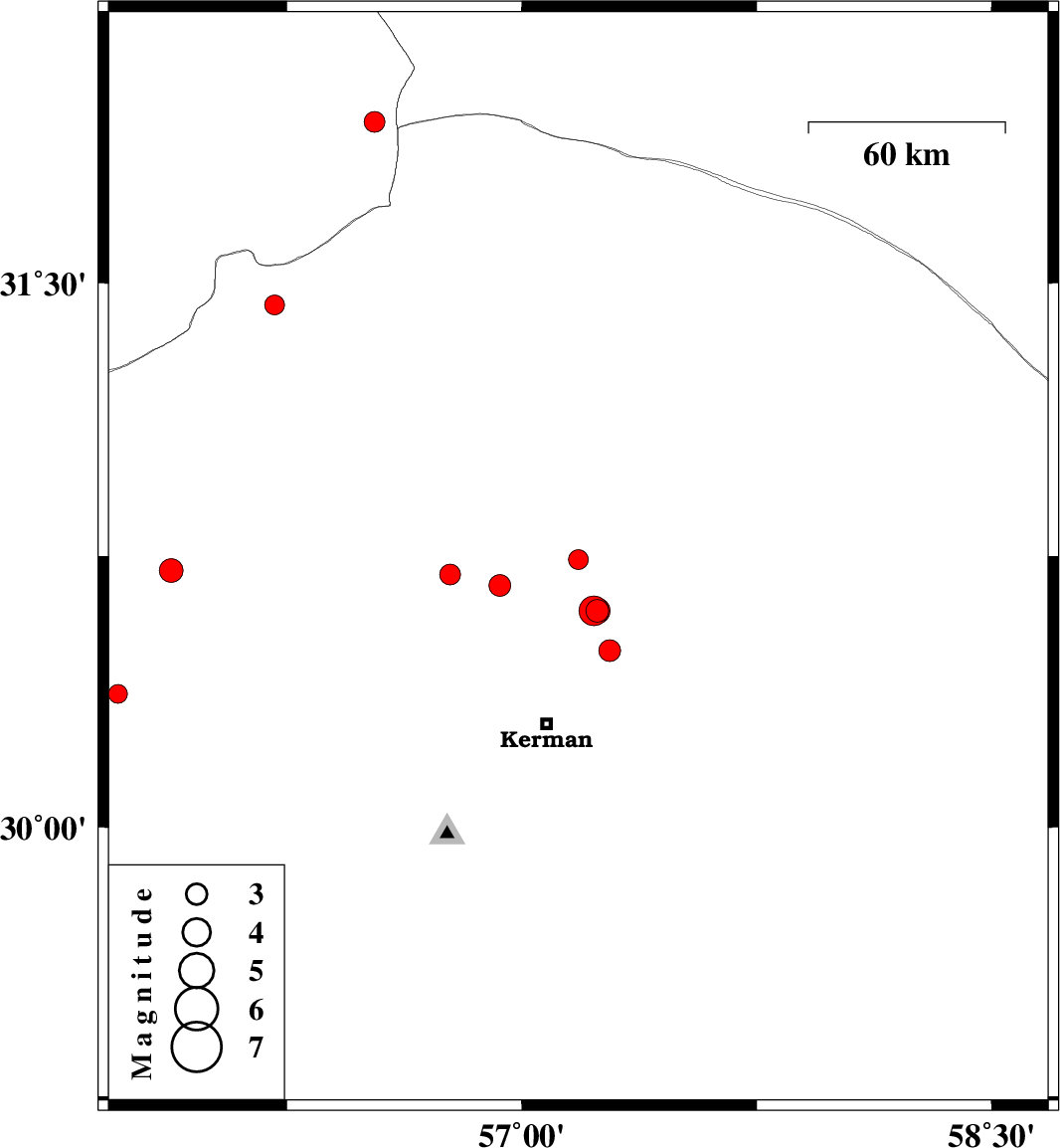
| 2013/09/24 | 16:12:32.7 | 19:42:32.7 | 30.74 | 57.18 | 15 | ML:2.8 | Kerman Province, 51 km North-East of Kerman | ||
| 2013/09/20 | 06:07:57.6 | 10:37:57.6 | 30.71 | 55.88 | 14 | ML:3.4 | Kerman Province, 35 km North-West of Rafsanjan | ||
| 2013/09/12 | 17:21:54.9 | 21:51:54.9 | 30.7 | 56.77 | 14 | ML:3 | Kerman Province, 22 km South-East of Zarand | ||
| 2013/09/09 | 00:06:45.3 | 04:36:45.3 | 31.44 | 56.21 | 15 | ML:2.8 | Kerman Province, 61 km North-West of Ravar | ||
| 2013/09/07 | 23:20:08.2 | 03:50:08.2 | 30.49 | 57.28 | 14 | ML:3.1 | Kerman Province, 29 km North-East of Kerman | ||
| 2013/09/01 | 12:56:15.8 | 17:26:15.8 | 30.37 | 55.71 | 14 | ML:2.7 | Kerman Province, 28 km West of Rafsanjan | ||
| 2013/08/31 | 21:21:31.2 | 01:51:31.2 | 31.94 | 56.53 | 14 | ML:3 | Yazd Province, 80 km North-West of Ravar | ||
| 2013/08/27 | 00:54:56.3 | 05:24:56.3 | 30.67 | 56.93 | 15 | ML:3.1 | Kerman Province, 38 km South-East of Zarand | ||
| 2013/08/25 | 15:07:18.3 | 19:37:18.3 | 30.6 | 57.24 | 14 | ML:3.2 | Kerman Province, 38 km North-East of Kerman | ||
| 2013/08/25 | 13:56:32.2 | 18:26:32.2 | 30.6 | 57.23 | 15 | ML:4.3 | Kerman Province, 38 km North-East of Kerman | ||
| 2013/08/25 | 12:55:36.1 | 17:25:36.1 | 30.6 | 57.24 | 14 | ML:3.7 | Kerman Province, 38 km North-East of Kerman |