Home / Recent Earthquakes

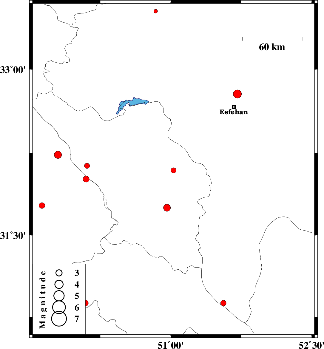
| Prel. Rep. | Date | Time(UTC) | Time(Local) | Lat. | Lon. | Depth | Mag. | Region | Waveform |
| 2013/04/23 | 04:34:55.3 | 09:04:55.3 | 32.09 | 51.03 | 18 | ML:2.5 | Chaharmahal Bakhtiari Province, 28 km North-West of Borujen | ||
| 2013/04/19 | 20:22:34.6 | 00:52:34.6 | 32.78 | 51.71 | 14 | ML:4 | Esfahan Province, 13 km North of Esfahan | ||
| 2013/04/19 | 13:06:35.4 | 17:36:35.4 | 31.75 | 50.96 | 15 | ML:3.4 | Chaharmahal Bakhtiari Province, 31 km North-East of Lordegan | ||
| 2013/04/17 | 16:06:14.0 | 20:36:14.0 | 33.52 | 50.84 | 45 | ML:1.9 | Esfahan Province, 52 km East of Golpayegan | ||
| 2013/04/12 | 09:05:14.9 | 13:35:14.9 | 31.77 | 49.63 | 15 | ML:2.8 | Khoozestan Province, 24 km West of Izeh | ||
| 2013/04/06 | 20:15:48.9 | 00:45:48.9 | 32.13 | 50.11 | 17 | ML:2.6 | Chaharmahal Bakhtiari Province, 38 km South of Chelgard | ||
| 2013/04/06 | 19:44:14.1 | 00:14:14.1 | 32.23 | 49.8 | 46 | ML:3.5 | Khoozestan Province, 44 km North of Izeh | ||
| 2013/04/05 | 20:01:30.1 | 00:31:30.1 | 30.88 | 50.09 | 15 | ML:3 | Kohkiluieh va boyerahmad Province, 35 km North-West of Behbahan | ||
| 2013/03/30 | 07:18:24.3 | 11:48:24.3 | 30.88 | 51.56 | 18 | ML:2.7 | Esfahan Province, 10 km Sisakht | ||
| 2013/03/27 | 15:53:04.2 | 20:23:04.2 | 32.01 | 50.1 | 41 | ML:3 | Khoozestan Province, 29 km North-East of Izeh |