Home / Recent Earthquakes

| Prel. Rep. | Date | Time(UTC) | Time(Local) | Lat. | Lon. | Depth | Mag. | Region | Waveform |
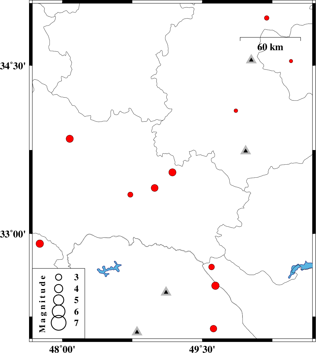
| 2013/09/03 | 20:04:58.5 | 00:34:58.5 | 33.55 | 49.18 | 14 | ML:3.5 | Lorestan Province, 12 km East of Dorud | ||
| 2013/09/03 | 15:15:45.2 | 19:45:45.2 | 34.54 | 50.45 | 14 | ML:1.7 | Qom Province, 41 km East of Ashtiyan | ||
| 2013/08/25 | 00:49:53.8 | 05:19:53.8 | 32.14 | 49.62 | 31 | ML:3.2 | Khoozestan Province, 37 km North-East of Masjed Soleyman | ||
| 2013/08/20 | 15:10:44.3 | 19:40:44.3 | 34.1 | 49.86 | 18 | ML:1.9 | Markazi Province, 16 km East of Arak | ||
| 2013/08/12 | 15:00:08.8 | 19:30:08.8 | 32.53 | 49.64 | 14 | ML:3.6 | Khoozestan Province, 46 km West of Chelgard | ||
| 2013/08/10 | 16:50:09.4 | 21:20:09.4 | 34.92 | 50.19 | 20 | ML:2.3 | Markazi Province, 20 km South-West of Saveh | ||
| 2013/08/09 | 03:45:31.3 | 08:15:31.3 | 33.35 | 48.73 | 14 | ML:2.6 | Lorestan Province, 35 km South-West of Dorud | ||
| 2013/08/08 | 15:41:25.3 | 20:11:25.3 | 32.7 | 49.6 | 15 | ML:2.8 | Chaharmahal Bakhtiari Province, 55 km North-West of Chelgard | ||
| 2013/08/06 | 12:46:06.8 | 17:16:06.8 | 33.41 | 48.99 | 16 | ML:3.4 | Lorestan Province, 11 km Dorud | ||
| 2013/08/06 | 07:33:39.1 | 12:03:39.1 | 32.91 | 47.76 | 14 | ML:3.6 | Ilam Province, 27 km South of Pol-e dokhtar | ||
| 2013/08/05 | 18:51:12.2 | 23:21:12.2 | 33.85 | 48.08 | 18 | ML:3.5 | Lorestan Province, 21 km West of Aleshtar |