Home / Recent Earthquakes

| Prel. Rep. | Date | Time(UTC) | Time(Local) | Lat. | Lon. | Depth | Mag. | Region | Waveform |
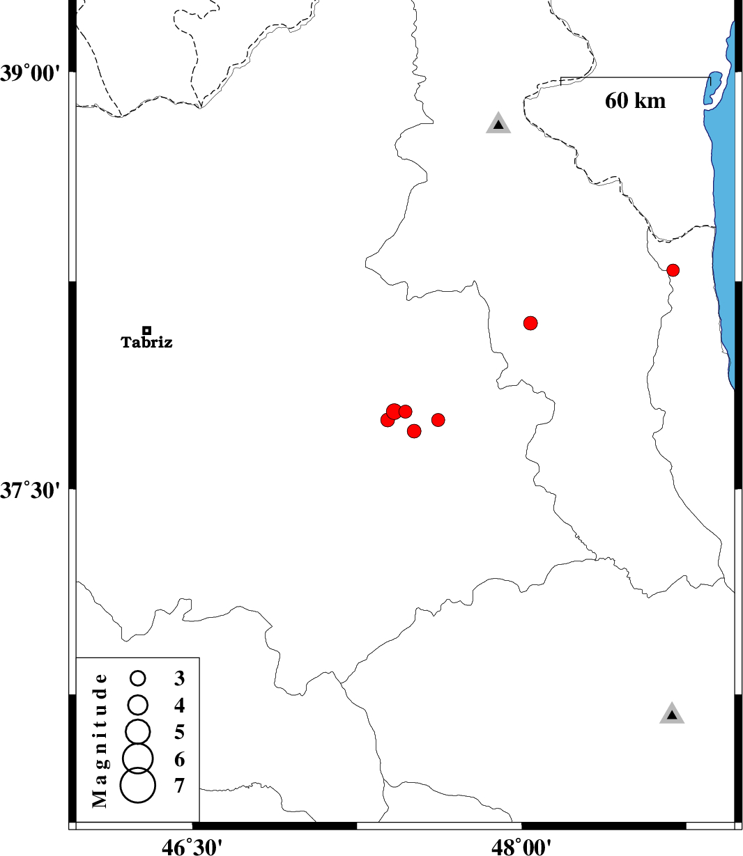
| 2019/12/08 | 22:32:45.2 | 02:02:45.2 | 37.78 | 47.47 | 10 | ML:2.7 | Azarbaijan Sharghi Province, 18 km South of Sarab | ||
| 2019/12/08 | 18:46:03.2 | 22:16:03.2 | 37.75 | 47.62 | 14 | ML:2.7 | Azarbaijan Sharghi Province, 22 km South of Sarab | ||
| 2019/12/08 | 02:09:06.9 | 05:39:06.9 | 38.1 | 48.04 | 10 | ML:2.8 | Ardebil Province, 8 km of Nir | ||
| 2019/12/08 | 00:27:10.3 | 03:57:10.3 | 37.71 | 47.51 | 10 | ML:2.8 | Azarbaijan Sharghi Province, 25 km South of Sarab | ||
| 2019/12/03 | 17:01:41.6 | 20:31:41.6 | 38.29 | 48.69 | 15 | ML:2.6 | Gilan Province, 21 km South-West of Astara | ||
| 2019/12/02 | 22:59:25.3 | 02:29:25.3 | 37.78 | 47.42 | 12 | ML:3.3 | Azarbaijan Sharghi Province, 20 km South-West of Sarab | ||
| 2019/12/02 | 13:45:08.8 | 17:15:08.8 | 37.75 | 47.39 | 14 | ML:2.8 | Azarbaijan Sharghi Province, 24 km South-West of Sarab |