| Prel. Rep. | Date | Time(UTC) | Time(Local) | Lat. | Lon. | Depth | Mag. | Region | Waveform |
|
|
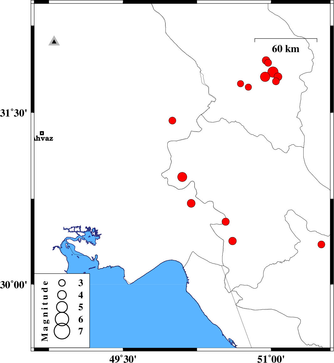
2013/02/06
|
16:10:12.9
|
19:40:12.9
| 30.94 | 50.1 | 14 |
ML:4.2
|
Kohkiluieh va boyerahmad Province, 40 km North-West of Behbahan | |
|
|
2013/01/29
|
16:49:15.0
|
20:19:15.0
| 31.75 | 50.69 | 18 |
ML:2.9
|
Chaharmahal Bakhtiari Province, 27 km South of Ardel | |
|
|
2013/01/29
|
16:32:15.1
|
20:02:15.1
| 31.72 | 50.77 | 18 |
ML:3
|
Chaharmahal Bakhtiari Province, 24 km North of Lordegan | |
|
|
2013/01/25
|
12:11:27.9
|
15:41:27.9
| 31.81 | 50.94 | 36 |
ML:4.4
|
Chaharmahal Bakhtiari Province, 37 km North-East of Lordegan | |
|
|
2013/01/25
|
02:37:43.0
|
06:07:43.0
| 30.35 | 51.51 | 46 |
ML:3.2
|
Fars Province, 26 km North of Nurabad | |
|
|
2013/01/23
|
06:37:02.7
|
10:07:02.7
| 30.38 | 50.61 | 14 |
ML:3.5
|
Kohkiluieh va boyerahmad Province, 17 km West of Dogonbadan | |
|
|
2013/01/22
|
08:44:01.9
|
12:14:01.9
| 30.55 | 50.54 | 15 |
ML:3.4
|
Khoozestan Province, 26 km South of Dehdasht | |
|
|
2013/01/21
|
18:07:01.1
|
21:37:01.1
| 31.43 | 50 | 15 |
ML:3.3
|
Khoozestan Province, 14 km East of Bagh Malek | |
|
|
2013/01/18
|
01:12:47.4
|
04:42:47.4
| 31.93 | 50.97 | 46 |
ML:3.2
|
Chaharmahal Bakhtiari Province, 31 km West of Borujen | |
|
|
2013/01/14
|
02:26:29.8
|
05:56:29.8
| 31.95 | 50.95 | 18 |
ML:3.5
|
Chaharmahal Bakhtiari Province, 28 km East of Ardel | |
|
|
2013/01/12
|
06:29:02.5
|
09:59:02.5
| 31.77 | 51.05 | 46 |
ML:3.3
|
Chaharmahal Bakhtiari Province, 31 km South-West of Borujen | |
|
|
2013/01/12
|
03:33:21.4
|
07:03:21.4
| 31.81 | 51.07 | 14 |
ML:3.7
|
Chaharmahal Bakhtiari Province, 27 km South-West of Borujen | |
|
|
2013/01/12
|
03:25:05.8
|
06:55:05.8
| 31.85 | 51.02 | 14 |
ML:4.8
|
Chaharmahal Bakhtiari Province, 29 km South-West of Borujen | |
|
|
2013/01/07
|
03:38:18.6
|
07:08:18.6
| 30.71 | 50.19 | 15 |
ML:3.6
|
Khoozestan Province, 13 km North of Behbahan | |