Home / Recent Earthquakes

| Prel. Rep. | Date | Time(UTC) | Time(Local) | Lat. | Lon. | Depth | Mag. | Region | Waveform |
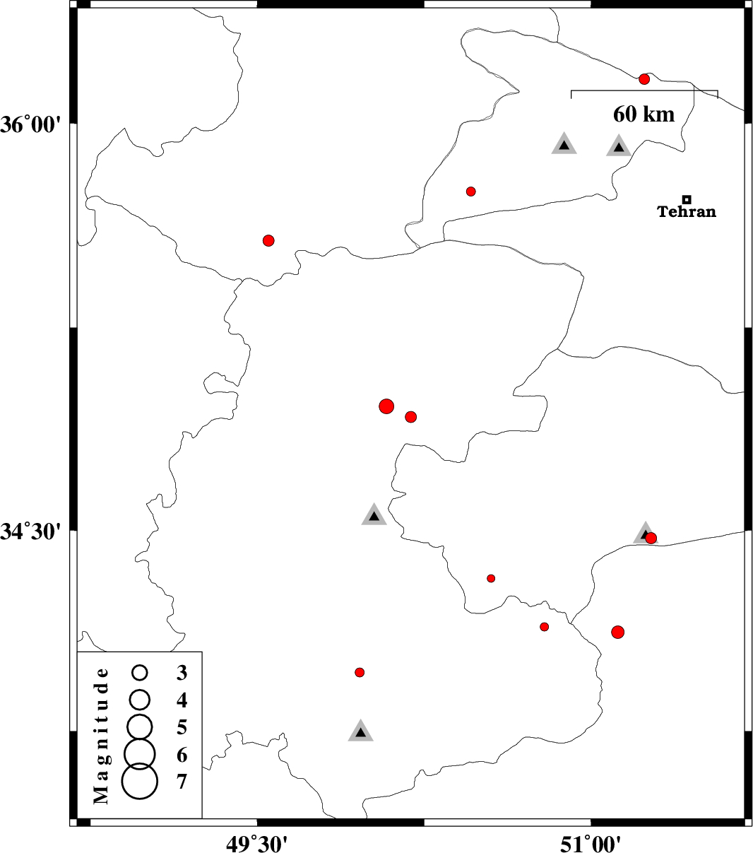
| 2013/08/10 | 16:50:09.4 | 21:20:09.4 | 34.92 | 50.19 | 20 | ML:2.3 | Markazi Province, 20 km South-West of Saveh | ||
| 2013/08/07 | 19:10:10.4 | 23:40:10.4 | 35.57 | 49.55 | 14 | ML:2.2 | Ghazvin Province, 57 km South-West of Takestan | ||
| 2013/08/03 | 05:06:00.6 | 09:36:00.6 | 33.76 | 48.9 | 7 | ML:2.7 | Lorestan Province, 20 km South-East of Borujerd | ||
| 2013/08/02 | 20:48:06.7 | 01:18:06.7 | 33.7 | 48.91 | 14 | ML:3 | Lorestan Province, 26 km South-East of Borujerd | ||
| 2013/07/31 | 17:47:48.1 | 22:17:48.1 | 36.16 | 51.24 | 14 | ML:2.1 | Tehran Province, 44 km North-West of Tajrish | ||
| 2013/07/29 | 13:41:56.5 | 18:11:56.5 | 34.32 | 50.55 | 10 | ML:1.5 | Qom Province, 38 km North-West of Delijan | ||
| 2013/07/29 | 11:36:22.3 | 16:06:22.3 | 34.14 | 50.79 | 46 | ML:1.7 | Markazi Province, 20 km North-East of Delijan | ||
| 2013/07/29 | 07:14:52.3 | 11:44:52.3 | 34.12 | 51.12 | 19 | ML:2.5 | Esfahan Province, 33 km West of Aran va bidgol | ||
| 2013/07/22 | 18:11:55.5 | 22:41:55.5 | 34.96 | 50.08 | 14 | ML:2.9 | Markazi Province, 30 km North of Tafresh | ||
| 2013/07/21 | 02:39:38.1 | 07:09:38.1 | 35.75 | 50.46 | 15 | ML:1.8 | Tehran Province, 23 km South-West of Nazarabad-E-Bozorg | ||
| 2013/07/18 | 14:12:13.1 | 18:42:13.1 | 33.57 | 49.1 | 12 | ML:2.7 | Lorestan Province, 11 km Dorud | ||
| 2013/07/18 | 09:40:16.2 | 14:10:16.2 | 33.97 | 49.96 | 9 | ML:1.8 | Markazi Province, 28 km South-East of Arak | ||
| 2013/07/16 | 22:34:18.0 | 03:04:18.0 | 34.47 | 51.27 | 6 | ML:2.2 | Qom Province, 42 km South-East of Qom |