
| Prel. Rep. | Date | Time(UTC) | Time(Local) | Lat. | Lon. | Depth | Mag. | Region | Waveform |
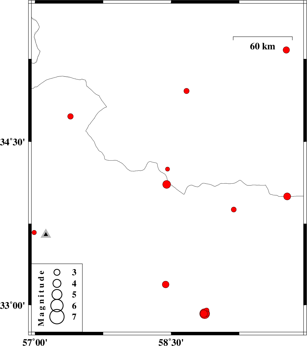
| 2013/10/28 | 16:10:31.9 | 19:40:31.9 | 34.25 | 58.46 | 29 | ML:2.1 | Khorasan(center) Province, 24 km West of Gonabad | ||
| 2013/10/28 | 10:32:34.3 | 14:02:34.3 | 34.11 | 58.45 | 18 | ML:4 | Khorasan(center) Province, 26 km East of Ferdows | ||
| 2013/10/27 | 17:51:43.5 | 21:21:43.5 | 35.33 | 59.77 | 42 | ML:3.2 | Khorasan(center) Province, 42 km South of Fariman | ||
| 2013/10/26 | 09:11:50.9 | 12:41:50.9 | 33.88 | 59.19 | 35 | ML:2.5 | 16 km North of Qaen | ||
| 2013/10/21 | 12:20:24.3 | 15:50:24.3 | 34 | 59.78 | 18 | ML:3.5 | 61 km North-East of Qaen | ||
| 2013/10/18 | 23:28:08.5 | 02:58:08.5 | 33.67 | 56.99 | 14 | ML:2.2 | Yazd Province, 10 km Tabas | ||
| 2013/10/16 | 01:05:19.2 | 04:35:19.2 | 34.96 | 58.67 | 14 | ML:2.7 | Khorasan(center) Province, 36 km South-East of Kashmar | ||
| 2013/10/05 | 18:37:01.3 | 22:07:01.3 | 32.92 | 58.86 | 16 | ML:3.7 | Khorasan(south) Province, 35 km West of Birjand | ||
| 2013/10/05 | 15:56:27.1 | 19:26:27.1 | 32.92 | 58.85 | 14 | ML:2.9 | Khorasan(south) Province, 35 km West of Birjand | ||
| 2013/10/05 | 01:17:03.5 | 04:47:03.5 | 32.92 | 58.89 | 14 | ML:2.8 | Khorasan(south) Province, 32 km West of Birjand | ||
| 2013/10/04 | 18:44:37.3 | 22:14:37.3 | 32.95 | 58.89 | 15 | ML:2.5 | Khorasan(south) Province, 33 km West of Birjand | ||
| 2013/10/04 | 18:17:27.1 | 21:47:27.1 | 32.92 | 58.87 | 15 | ML:4.9 | Khorasan(south) Province, 34 km West of Birjand | ||
| 2013/10/02 | 07:15:20.6 | 10:45:20.6 | 33.19 | 58.44 | 16 | ML:3.4 | Khorasan(center) Province, 94 km South-East of Ferdows | ||
| 2013/10/01 | 00:21:38.7 | 03:51:38.7 | 34.73 | 57.39 | 14 | ML:2.8 | Yazd Province, 78 km South-West of Bardeskan |

 IIEES All Rights Reserved